Saxilby Stopover
Torksey is the entrance to the Fossdyke Navigation, which runs eleven miles, broadly south-east, to the city of Lincoln. From there you join the River Witham, all the way down to meet the sea at The Wash, forty miles further on. Narrowboats do cross The Wash to King's Lynn and carry on up the Nene but it isn't a venture to be undertaken lightly and requires the services of a pilot. We were already clear that we did not intend to take on that challenge on this trip but we did want to visit Lincoln and had left it open as to how much farther we would go.
Foss Dyke has a claim to be the oldest navigation still in continuous use, generally considered to have been created by the Romans in 120 A.D. to link the River Witham at Lincoln with the River Trent. Between then and now it has, at times, been allowed to decline very badly but it does seem to have always had some level of traffic along it.
Having spent the night close to the start, at Torksey Lock, we set out on fourth August, towards Lincoln. The navigation has long straight reaches and the landscape is very open, flat and exposed with high flood banks a lot of the way, all very reminiscent of the Middle Levels and the Cambridgeshire Fens.
Straight Flat Cruise to Saxilby
For the first five miles there is nowhere to moor until you come to the village of Saxilby where the imaginatively named Saxilby Moorings Footbridge gives a clue that boats can moor on either side of it and on both sides of the cut. This still does not make room for a huge number of boats but we did find a space when we arrived there. The moorings and the services here seem to be owned and managed by Saxilby Parish council, rather than the Canal & River Trust. They seem to be neither the better nor worse for that.
Despite early cloud the weather was hot and sunny but with a strong wind. The moorings at Saxilby are quite pleasant with grassy banks and a little nature reserve behind them. There is a pub and a pizza takeaway, which got Sue's vote immediately. They had a really great recreation area with playing fields, playgrounds and skate parks behind the pub. Further inland was a useful Co-op store and another pub. Generally, it seemed a nice village and there weren't too many signs of vast new developments.
Lincoln For Lunch
On Friday we moved on to Lincoln. There are a couple of moorings in between but on fairly isolated pontoons with nothing much around them, although one is by a pub. Arriving in the outskirts of Lincoln, we passed a long, long run of private moorings to reach the CRT service point. While we were doing that, we saw some of the local residents riding into the city for the weekly shop.
People of Lincoln versus the Age Of The Motor Car
Just beyond there was a short length of forty-eight hour visitor moorings but there was no space there and the boats in situ, largely of the floating shed variety, seemed pretty settled.
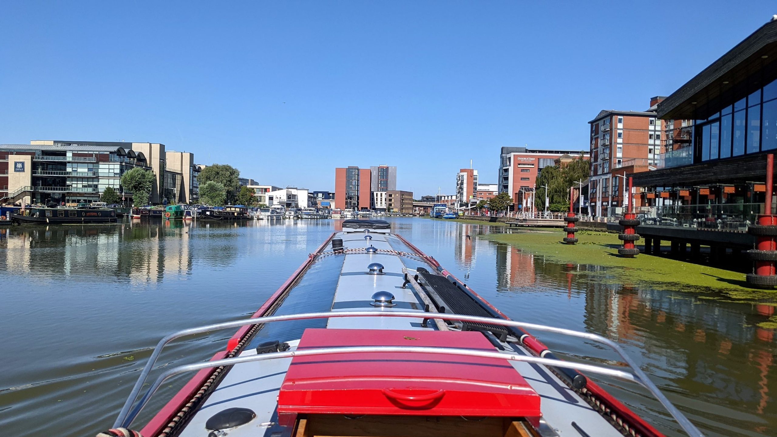
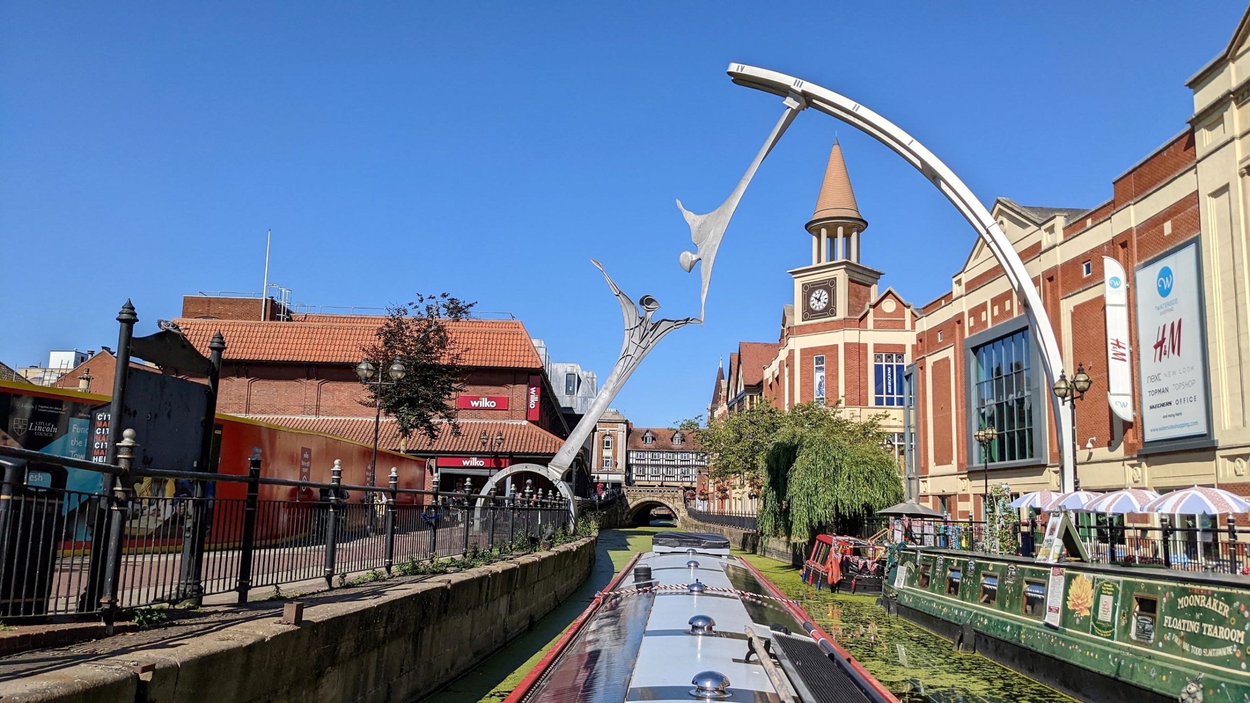
Through the next bridge the Canal opens out into a wide basin known as Brayford Pool.
Brayford Pool
It is shaped a bit like a funnel that you enter at the tip and it widens out toward the far end. The north side has been developed into a kind of Costa Del Lincoln with lots of modern shops, bars and a cinema fronting onto the water. The far side from there, to the south, is a marina, owned by the Brayford Trust, which provides permanent mooring and also offers space for visitors, at a price.
Brayford Pool From The Lincoln End
As far as we could see most of the visitor spaces that would accommodate a boat of our length were full, so we carried on to the far end of the pool. The non-navigable River Witham flows into the basin from the far right-hand corner and along the flat end of the pool. It leaves, as a navigable waterway, from the left-hand corner, passing under the Wigford Way Bridge. Effectively, this is where the Foss Dyke ends and the River Witham takes over.
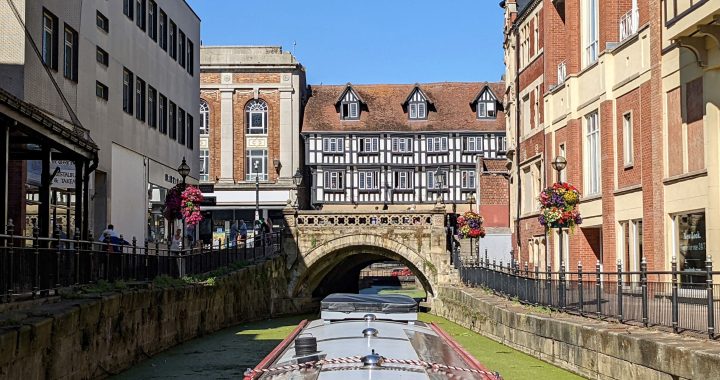
As you pass under the modern dual carriageway bridge you are now approaching the Glory Hole, the narrow, crooked arch under High Bridge, the oldest bridge in England that still has houses built on it.
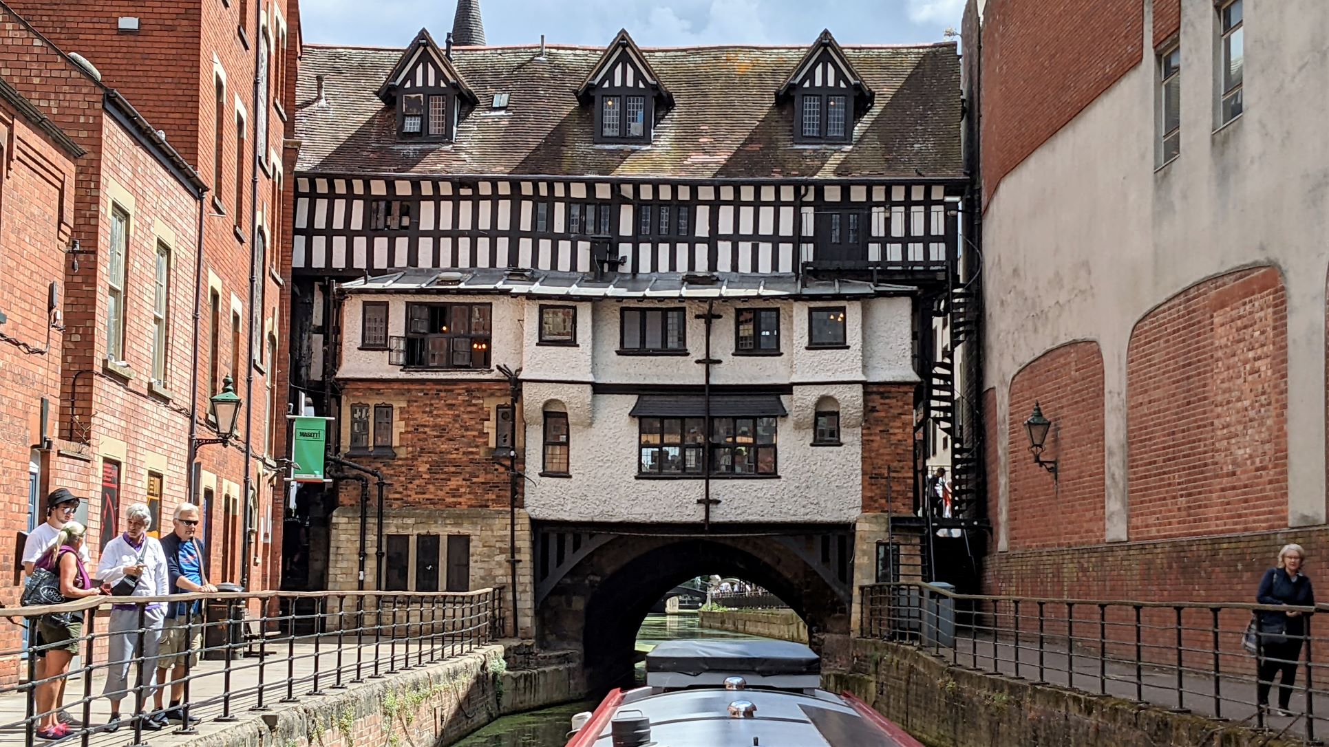
Approaching Lincoln's Glory Hole
The houses lining the west side of the bridge were built in the Tudor period and are now occupied by Stoke's Tea and Coffee, a local, family firm who run it as a rambling, three storey restaurant and tearoom.
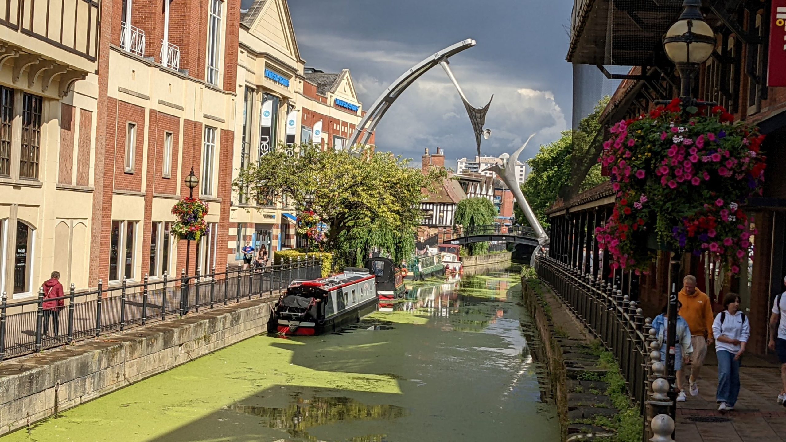
Passing under High Bridge, with the busy main High Street running over it, you emerge to find a small, modern shopping centre on your left and Wilko on your right. The river is separated from the walkway on either bank by iron railings and a sharp eye can just spot a little sign that says: "24 Hours Max". This is the only clue that you have arrived at the town's visitor moorings. There is space for two or three boats between the bridge and a floating tearoom, who also run a small trip boat up and down between the Brayford Pool and Stamp End Lock.
Between the high buildings, spanning the river, is the statue entitled "Empowerment". Commissioned for the millennium, to celebrate the city's industrial heritage, it features over-sized turbine blades transformed into human figures. At sixteen metres tall it is certainly imposing and loomed over us while we were moored there.
24 Hour Visitor Mooring In Lincoln
Beyond the little waterborne enterprises, a similar tiny plaque identifies the transition to "48 Hours Max" with room for another two or three boats before the river flows under a major road. There is no towpath to pass under the road and it is very purposely designed to prevent any pedestrian crossing over it. A boat, however, can slip through to the other side, where there is further space for mooring, still lined with the iron railings, with very occasional locked gates let into them so boaters can find their way out into the city.
We were moored up, just past the Glory Hole, by half past twelve and made our way up Steep Hill to the Cathedral quarter, where we found an open Tourist Information office and a nice cafe for a late lunch. We had a general look around, walking back down to the river and along to the boat but we had a few chores to do in the afternoon, such as collecting parcels from the Post Office for things we had ordered and some basic shopping. We thought about whether to stay in Lincoln and do a proper tour the next day. In the end we chose to avoid doing that on a Saturday, when the town must be at its busiest and leave it until we were on the return trip. Instead, we would move on in the morning and head further down the River Witham.
Our position, in a canyon, between the high buildings of the shopping centres, with the High Street running across not far behind us, did mean that we expected a fair amount of city noise in the evening. Traffic wasn't a problem but the whooping and carousing of Friday night revellers certainly echoed around the night-time streets. It was no surprise that it continued until one o'clock in the morning. Even the sound of a couple of people talking loudly, as they made their way home and said their farewells, was greatly magnified, particularly with drink taken. What was unexpected was the second wave that started about five o'clock in the morning. Whether this was chucking out time for some all-night bars and clubs or a few early risers, up with the lark and heading enthusiastically into work, was unclear but it certainly woke us and prevented sleep until more people began moving and it all blended into the day's constant background hum.
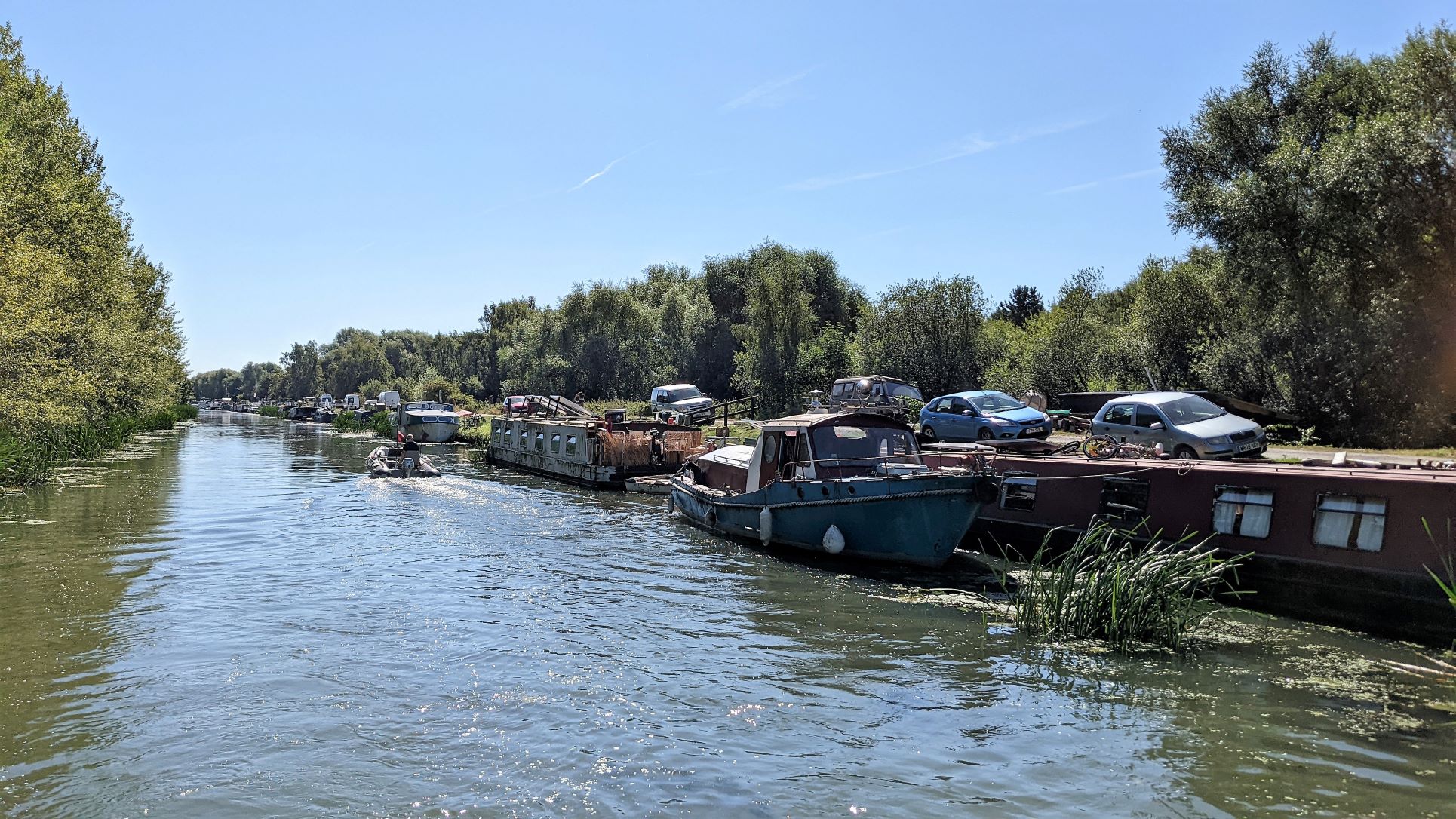
The River Witham
It doesn't get as much press as the Thames or the Severn but the Whitham is a proper river, with all that entails. Limited mooring, current flows, variable widths and often, wide margins of land that is barely managed since it is too vulnerable to the potential of rising waters to be used for building, cultivating or grazing.
As we had already determined that we would not go all the way down it, on this trip, we had a look at the map and thought we would go as far as a couple of forty-eight hour moorings at a place called Southrey, about eleven miles from Lincoln, before turning round and coming back. That would avoid doing Lincoln at the weekend and give the weather a chance to cool off a little. Our first leg was going to be as far as Bardney Lock, about eight miles away, where there were seventy-two hour moorings and service facilities.
Setting out from Lincoln we would leave the city via Stamp End Lock. This turned out to be a manually operated guillotine lock, of a type and design we last saw back on the River Nene last year. We were slightly confused, at first, as the only lock landing seemed to be full of canoes and children, neither of which should be using the lock. It turned out to be a group of scouts whose leader had thought it would be interesting or educational for them to see the lock and weir workings. We managed to get alongside the pontoon, despite the clutter and she gradually assembled her flock and got them back into the water and safely out of the way.
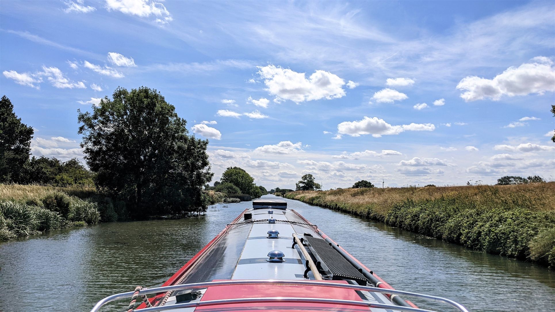
Dropping down below the lock we entered a world that reminded us of the Cambridgeshire Fens just as strongly. Flat, with high banks, little to see and very straight. It was pleasant enough in the sunshine and there is always wildlife about but it was quite dull.
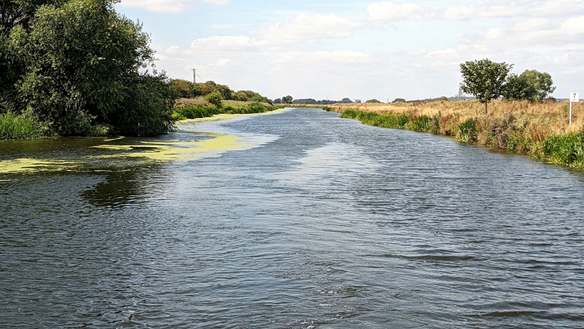
Straight As A Die River Whitham
Again, there were a couple of two-day mooring pontoons along the way. There is supposed to be a marina under construction at Cherry Willingham but we saw no sign of any work actually happening.
Arriving at the moorings before Bardney Lock there was just one space free, although, as we came in, one of the boaters there popped up to say that, if we could not get in, he was just about to leave, himself. We wanted to stop here anyway but had been debating whether to go through the lock and moor on a pontoon half a mile further on, a little closer to the village of Bardney. Walking up to the water point beside the lock we could see that the approach, the service wharf, the lock itself and the river below were all absolutely choked with weed. It was so thick that we could actually see a whole motor-cycle wheel, complete with tyre, just sitting on top of the green scum without falling through.
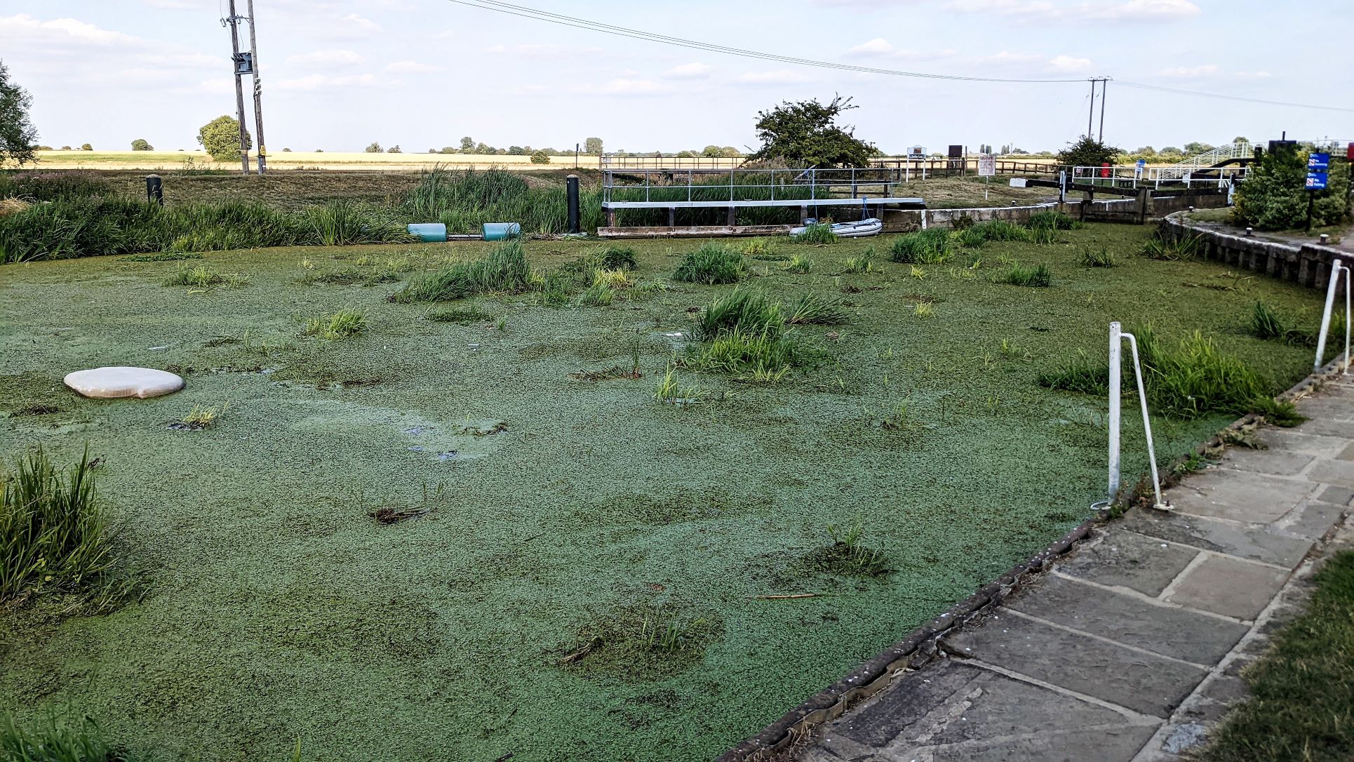
The Approach To Bardney Lock
It would have been possible, I am sure, if we had intended to go much further down towards Boston. Since we had already decided we would only be going another three or four miles and then only just to see what it was like, there was really no point in forcing our way through, potentially just clogging up the propellor or the bow thrusters. We would give Southrey a miss, stop at this lock and go back to Lincoln on Monday from here.
Bardney - Biding Our Time
There are no footpaths or bridleways linking Bardney with the river, which we found surprising as it seems to have been important to the prosperity of the community in the past. There are paths to the north to the old Abbey and then joining the Viking Way and to the south out to a nature reserve but the real link to the river is Station Road, which comes straight out to meet the navigation at Bardney Bridge to the south-west of the main village. However, the very well surfaced National Cyle Route Number One runs alongside the Whitham, past the lock and down to the bridge. That provided a nice, safe, off-road route where we could give Archie a run before walking up Station Road into the centre.
The Bardney Heritage Centre by the bridge offered an exhibition and cafe with accommodation specifically geared for touring cyclists. On the day of our visit, it was, of course, closed for a private function, which seemed to be a wedding reception. The walk up to the village is dull, past houses from various eras that have expanded out from the original agricultural settlement to take advantage of the improved transport links on first the river, then the railways and the sugar factory that provided work for the greater part of the twentieth century. The centre is more attractive, with a small Post Office and store as well as a Co-op and a couple of pubs that seemed quite busy. There are older properties here and a number of old farm buildings by the church as well as a memorial to the killed and missing members of IX Squadron RAF, who flew Lancasters from RAF Bardney during the Second World War.
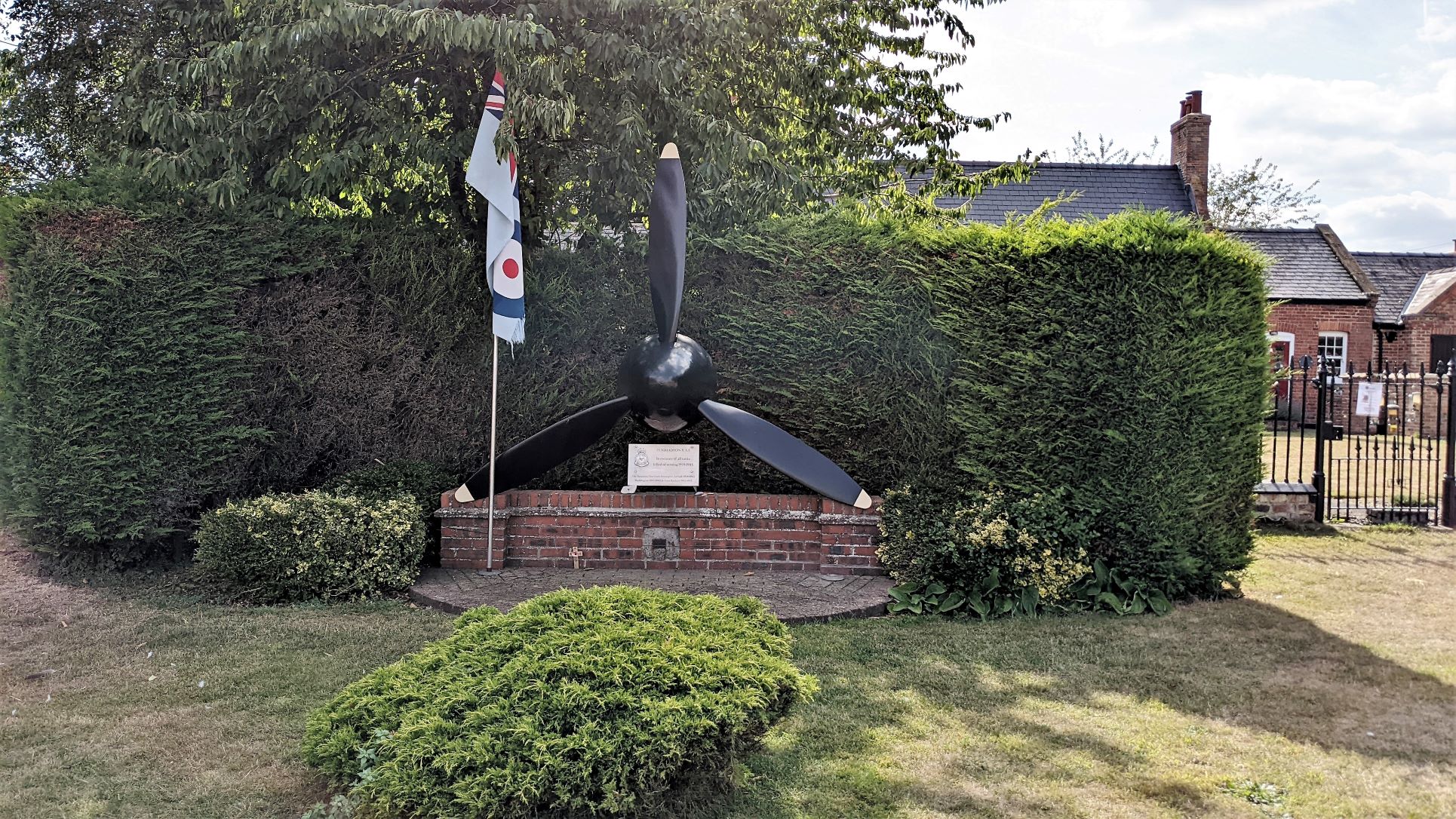
The Memorial to XI Squadron RAF
That association is also incorporated into the village sign, which also references the open door of the Abbey, the ancient Bardney Lime woods, the Parish church and the bridge, the first road bridge downstream of Lincoln.
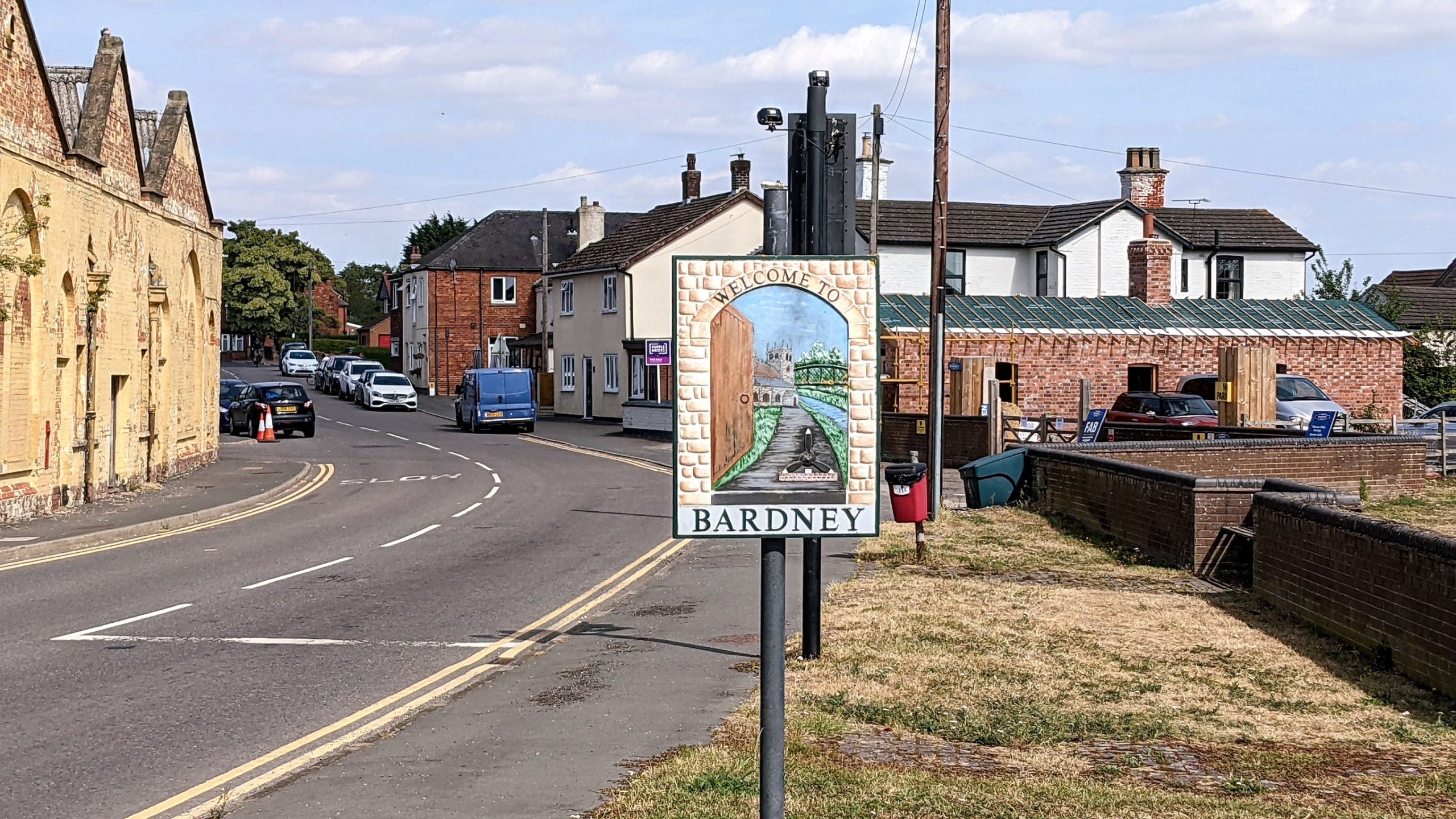
Bardney Village Sign - Quite Well Thought Out
We had an ice cream and a long chat with a passing villager, who was very taken with Archie, before moving on to find a short loop of footpath out near the abbey ruins that then looped back to Station Road again past the extensive coops of a local pigeon fancier, whose car registration did make us laugh.
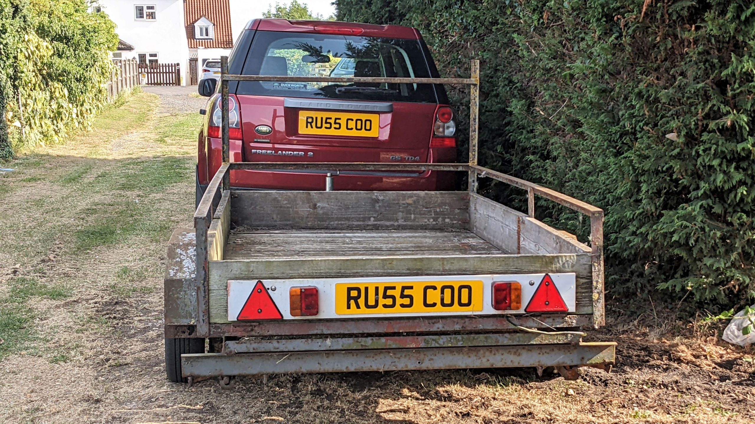
Pigeon Fanciers Are Not Without Vanity
While we were exploring Bardney we saw posters for the Saint Oswald's Day Feast to be held the next day. Since we were not moving on to Southrey but not ready to go back to Lincoln until Monday, we decided we would walk back into Bardney on Sunday morning. We could have a look at the now, hopefully, re-opened Heritage Centre and then wander up to the village to see what the feast day event had in store.
The Heritage Centre was, indeed, open when we arrived but something of an anti-climax. It consisted of a brick building, that may have been a railway station once, with a couple of wagons on a piece of track beside it and a large engine shed that may have become a function room. In the station building there was a tearoom, of sorts, and scattered around the walls were various forms of memorabilia, including a selection of old photographs. The collection was not extensive, there was no discernible order or system to these 'exhibits' and there was very little explanation of their significance or context. It is harsh to judge the efforts of committed volunteers and we have no idea what stage in its development this attraction has reached but I'm afraid we felt underwhelmed.
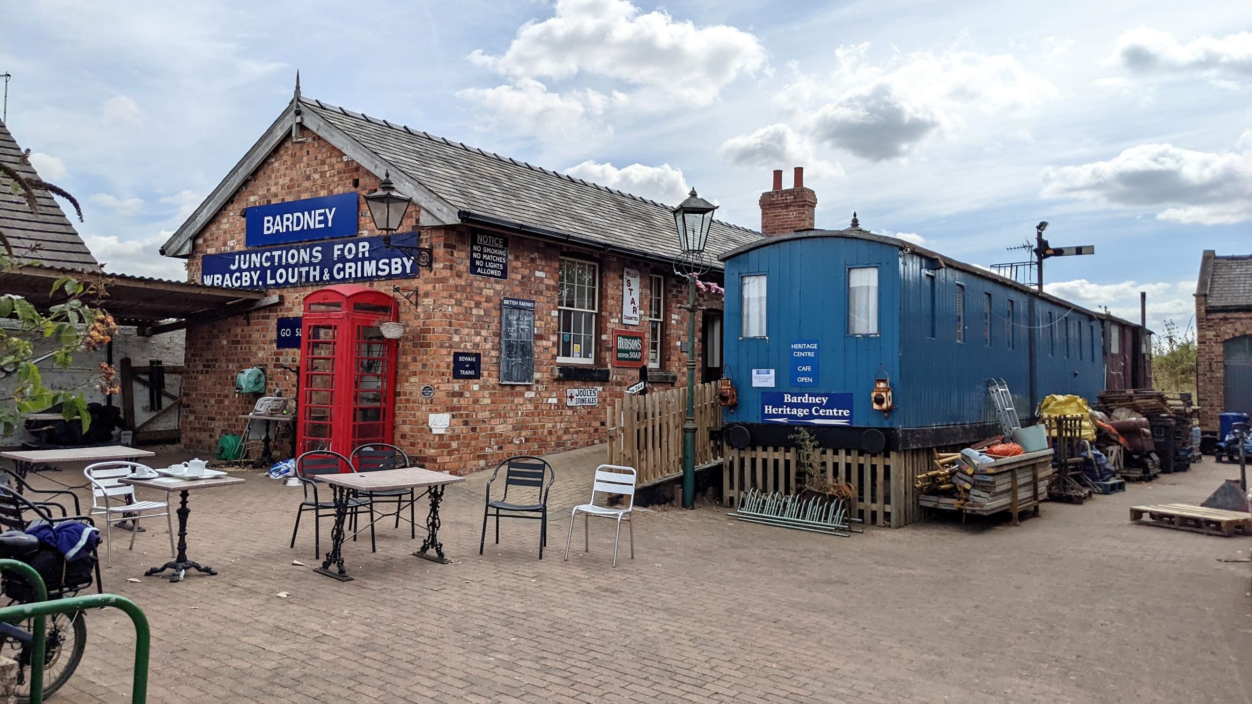
Bardney Heritage Centre
We did support their efforts by purchasing some drinks to have out in the sunshine. There we watched people emerging, blinking, into the sunlight, in varying states of dress and stages of recovery, from the engine shed and from an old shepherds hut on wheels that lurked in a corner of the courtyard. We assumed these were the wedding guests from the day before who had stayed over, sleeping rough, after extensive nuptial celebrations.
Moving on, we advanced to the village centre and had a look around St. Lawrence church.
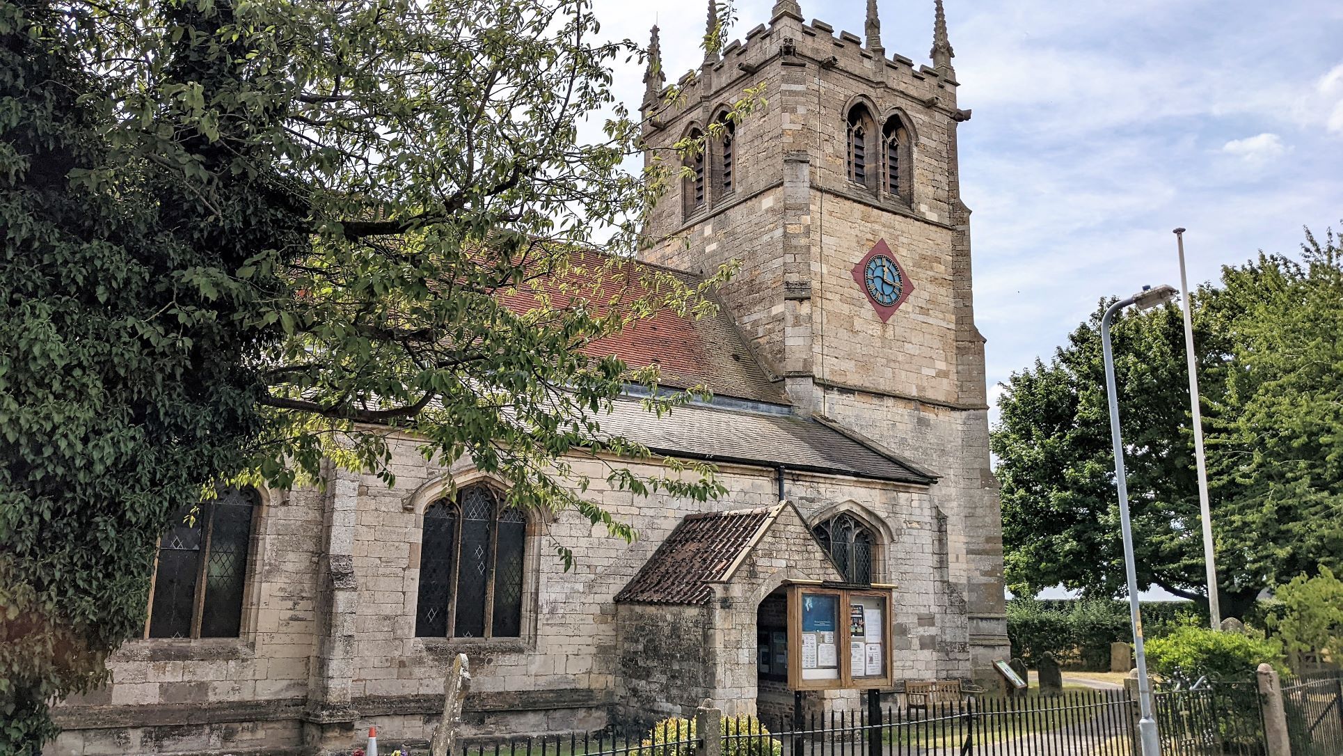
St. Lawrence Church, Bardney
An information board on the cycle trail had included the information that this was a replacement for an earlier building that had collapsed in 1432. It appears the villagers were then invited to attend services in the monks' chapel at Bardney Abbey but caused such a nuisance that the monks built this replacement for them in 1434. It seems being a nuisance was a much faster approach than the earnest fund raising that goes on behind many restoration 'thermometers' one sees around the country in modern times.
By now, it was midday and we sought out the field where the Feast Day was to be held. It was easy to find and for quite a small village, was impressive in its size and the range of facilities it offered. Although it had been advertised as "Music, Food and Merriment starts at 12 noon", they weren't quite ready for their day when we arrived.
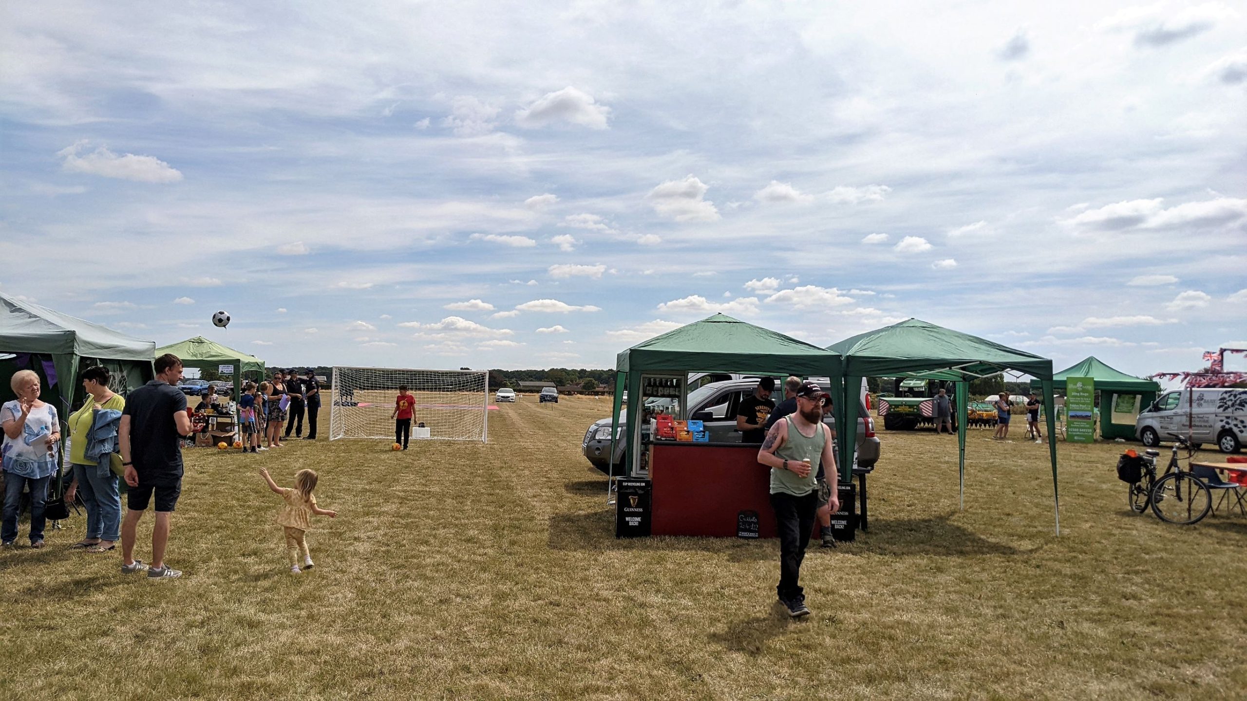
St Oswald Feast Day - Still Setting Up
The mobile sound stage had not yet reached the point of the interminable "one, two. one, two" sound checks heard at every such event and the Bardney roadies were still festooned in cables and gaffer tape, watched by a small crowd of eager, early picknickers.
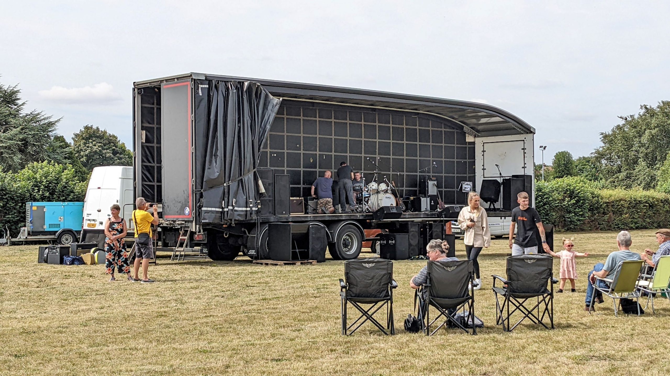
Bardneystock Still Tuning Up
We wandered around the stalls still arriving and setting up and eventually decided to go and watch the dog show scheduled for one o'clock. Ten minutes later Sue was in the ring with Archie, scooping up the Third-Place rosette for the 'Best Puppy' class.
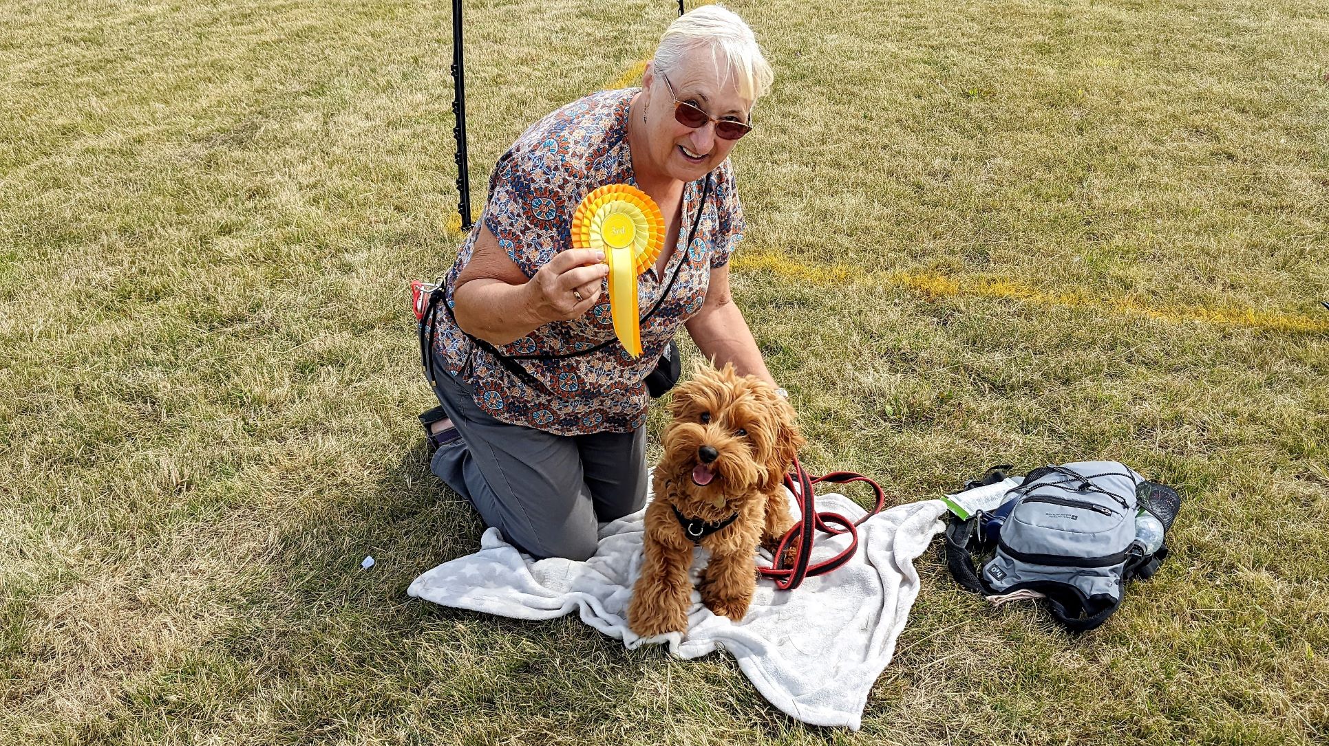
Triumphant Puppy and Handler
By now, the field was taking on a very different feel with a definite buzz that wasn't just the feedback from the microphones they had got working at last. The first band was starting their set, there was a much bigger crowd to watch and the street food truck was finally open for business.
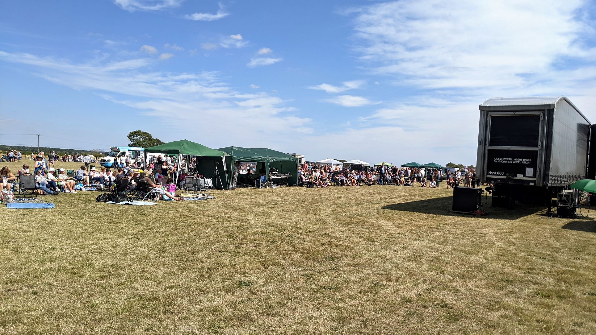
Feast Day In Full Swing - With The Sound Stage Up And Running.
Rather disappointingly, Bardney's idea of street food consists of a burger or a sausage in a bun, so we rather wished we hadn't held out and had just gone to the chip shop stall that had been up and running from the start. We had been round a couple of times, by then, so we left shortly afterwards and headed back to the boat via a pint in the sun at The Old Angel Inn.
Return To Torksey
Turning round on Monday morning presented no real problems. The weather stayed hot and sunny but more cloud came in later, making it feel unpleasantly stuffy and humid. An uneventful return trip to Stamp End Lock made for an enjoyable cruise, if a little dull. However, we did spot a couple of the art works that have been installed along the Water Rail Way. This is the purpose-built cycle trail that has been created along the line of the old railway with the help of Sustrans. There are thirteen of these artworks along the trail and two of them are visible from the river near Washingborough and Fiskerton.
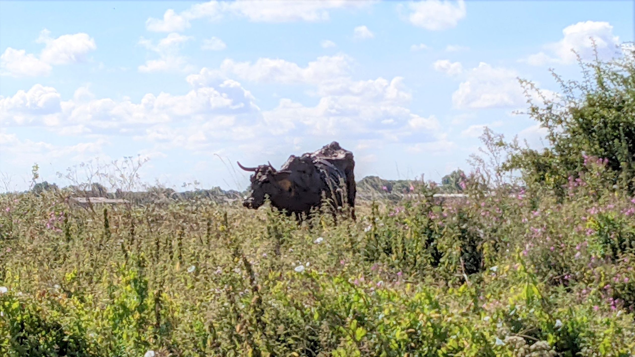
Lincoln Red Cattle by Sally Matthews
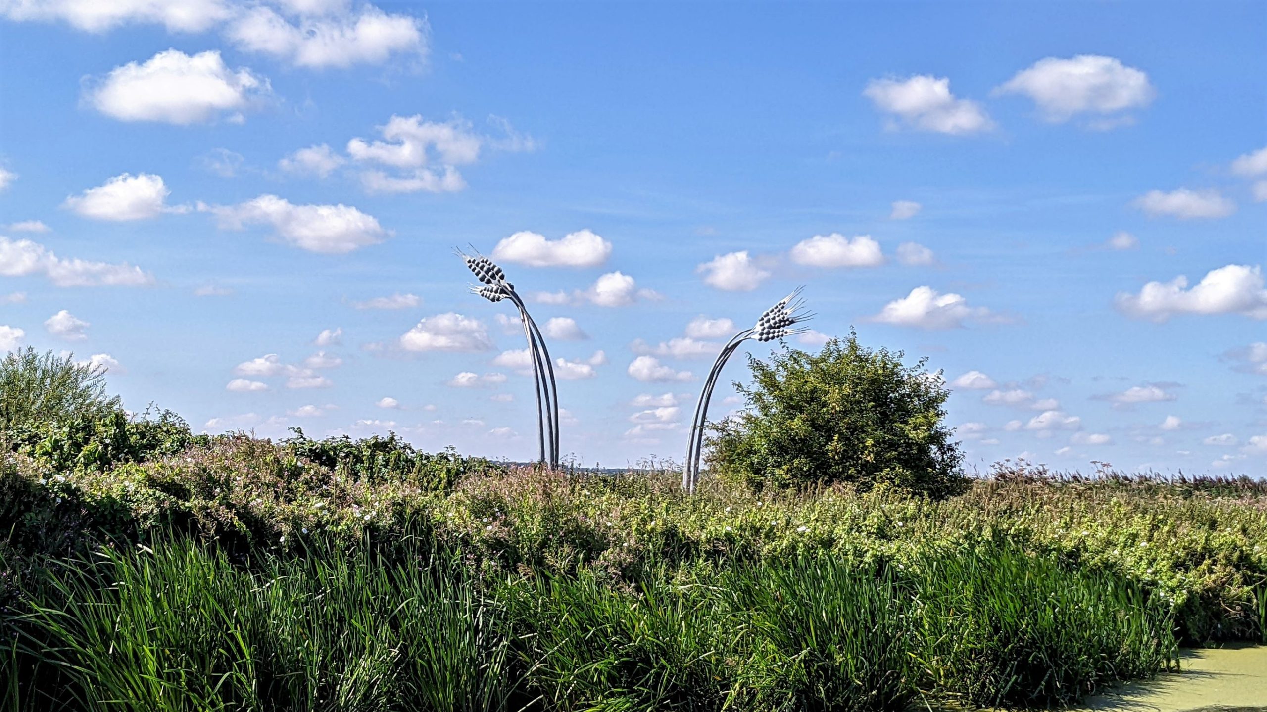
Lady of Shalott by Anwick Forge
We chose to moor in the fourteen-day area nearer the lock and just managed to squeeze in at the city end by tying off the bow to the railings, as the mooring rings ran out. Behind us a strange cruiser-like boat, laden with the contents of several skips, was barely tied on with a piece of string and swung back and forth with the passage of each boat or every gust of wind. We couldn't do much about it and consoled ourselves that eighteen tonnes of steel were unlikely to come off worst in a series of collisions with plastic and wood. We were also right opposite Doughty's Oil Mill, a Grade II listed building that now seems to have been converted to apartments.
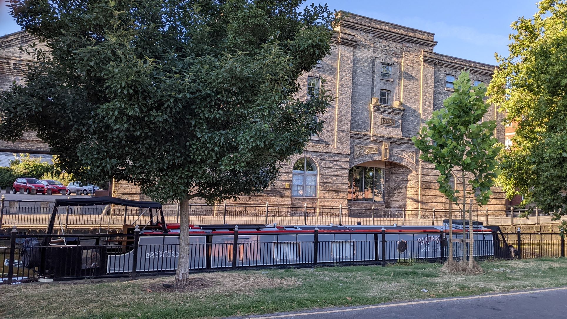
Moored Back In Lincoln Opposite Doughty's Oil Mill
The afternoon was devoted to taking the heavy laundry to the nearest laundrette, which was a good walk away and to getting the big weekly shop from Tesco. Away from the old city, Lincoln is not a great place to walk around. The long straight road heading south away from the tourist area is like walking down the main road in Croydon, a long, boring succession of fast-food shops, nail bars, tattoo parlours, grimy looking pubs and foreign grocers.
Lincoln, South Of The River - Pretty Grim But It Still Has A View Of the Cathedral
Eventually it comes close to an area known as South Commons, which is traditional common land. It has acres of grassland criss-crossed by tracks, formal and otherwise and is still being used to graze horses that are just roaming free. A great place for Archie and a welcome relief to find some fresh air in the stifling afternoon heat. We followed it east to where it meets the main road, which is busy with fast-moving traffic and offers very little opportunity for a pedestrian to cross. If you are on foot, you are forced well out of your way to take dank, smelly underpass routes to get to the other side.
Tuesday, ninth August started with the dramatic rescue of a stranded pigeon trapped in the weed outside the boat. It must have been stuck for hours and seemed to have given up the struggle to free itself, looking to be on its last gasp when Sue plucked it from the water.
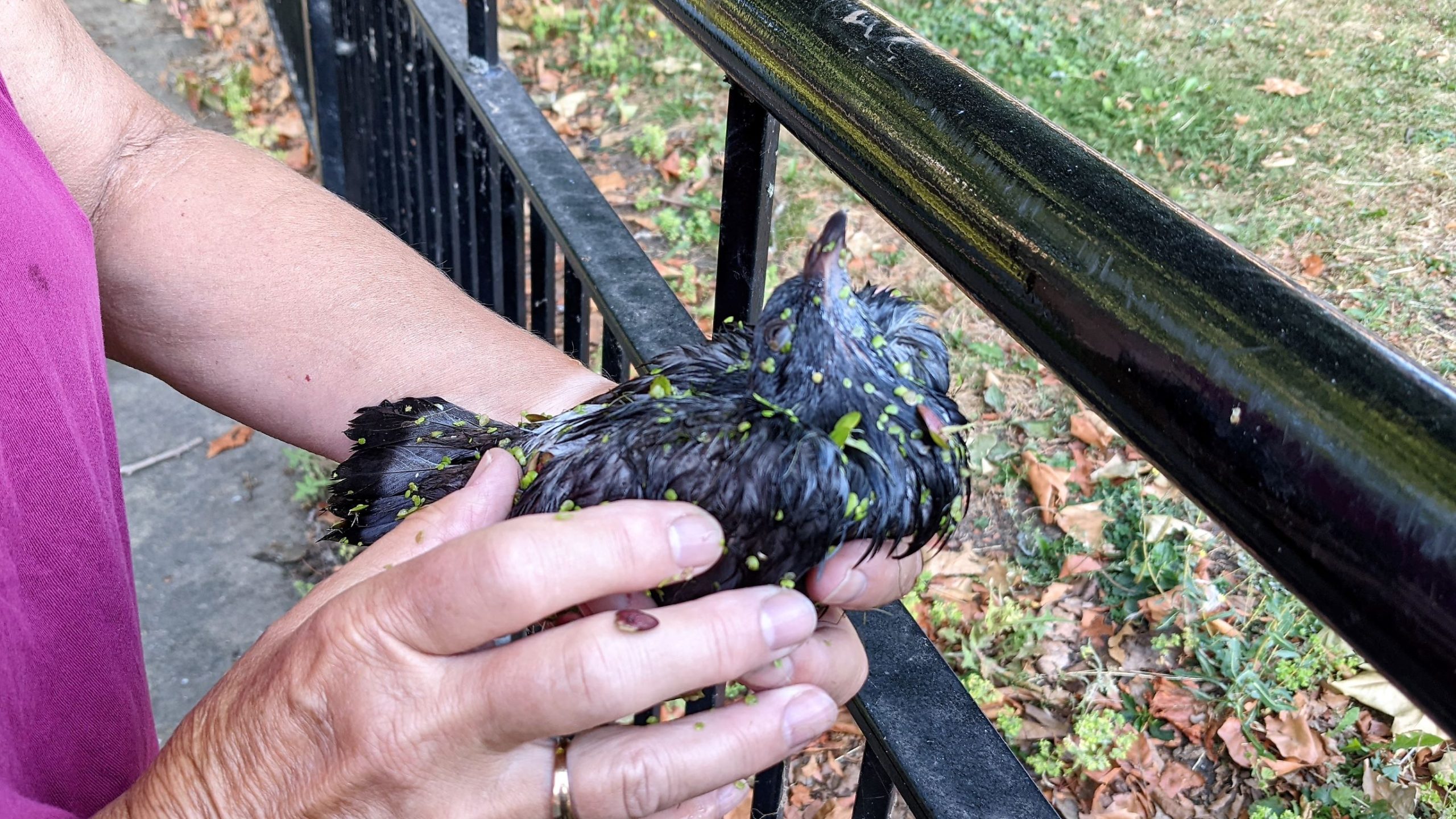
Sue Comes To The Rescue
Sue dried it off and left it on the grassy riverbank beyond the fence to try and recover. Later in the day it had disappeared, so we like to think it recovered and flew off eventually.
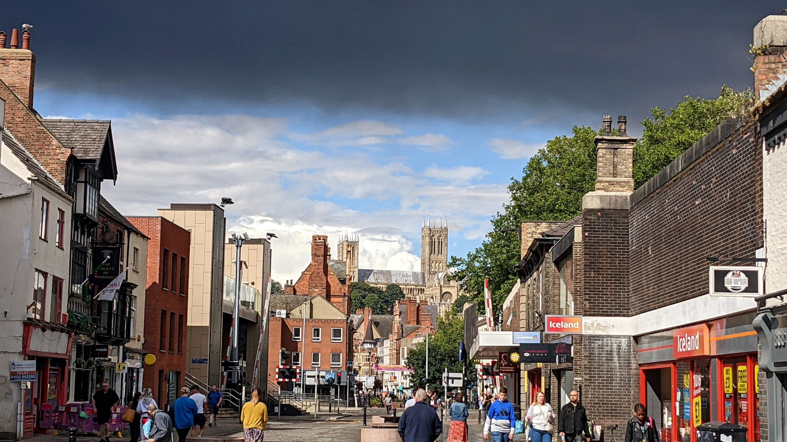
It stayed hot and sunny for our walking tour of Lincoln. The guide obtained from the Visitor Centre had four walks around four quarters of the city, centred on the cathedral and castle and extending down picturesque Steep Hill and as far as the High Street, Brayford Pool and the Glory Hole. We were able to complete them all and enjoyed the tour, this part of the city is really lovely. One of the most interesting sites, halfway down the High Street, is the Stonebow, a fourteenth century stone arch, built on the remains of the original Roman South Gate and passing through the building containing the Guildhall. A century in construction and completed in fifteen twenty, this historic building has served as a council chamber for nearly five hundred years and the city council still holds regular meetings there. The Motte Bell, which is rung to summon councillors to meetings is older still, dating back to thirteen seventy-one.
We felt obliged to have lunch at Stoke's, sitting outside in the High Street, on the bridge over the River Whitham, above the Glory Hole.
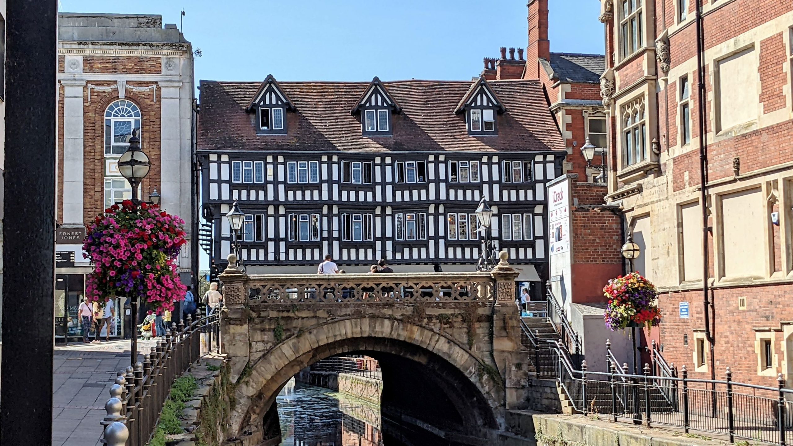
Stoke's High Bridge Cafe
I went inside the building for a look round and it was fascinating to look out of the back windows on the third floor at the navigation passing underneath. We overhead the waiters, who all provided unusually excellent service, explaining several times, to various customers, that they do not serve the full lunch menu outside, simply because of the difficulty of serving it up and getting it down from the small, cramped kitchen. It sounds a bit feeble but having seen the inside and climbed the narrow ramshackle staircases and corridors they would have to negotiate with trays of hot food, I could see that it was a perfectly reasonable policy.
The washing still needed to be collected so while I fetched that, Archie got a run round the Arboretum with Sue. Returning to the boat we found our barely tethered neighbour had moved on although, sadly, not without a trace; the washing machine and big bag of rubbish, now lying on the riverbank under a tree, were definitely last seen sitting on his foredeck.
Wednesday was hotter still, up to thirty-one degrees at one point. We left Lincoln for Saxilby, passing under "Empowerment" and past the floating tearoom and trip boat we had moored by on the way in.
Passing Under "Empowerment" On The Way Out Of Lincoln
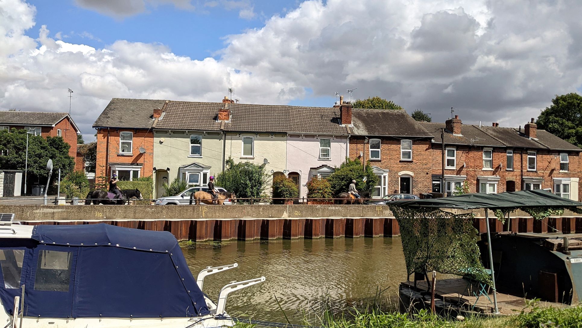
On the way out of Lincoln we were reminded of just how far the moored boats extended along private moorings. They seemed to go on forever, as we slowed to a tick-over going past them. The further east you go, the more weed there is by the bank, the shabbier the boats get and the more precariously they are secured to the land.
Miles Of Boats As We Leave Lincoln
We found the moorings at Saxilby very full but we were able to moor on the offside, by the road, by putting in a couple of pins. It wasn't a day for running around but once it started to cool off a bit, we took Archie down for a run on their excellent playing fields and stopped off at The Sun for a pint on the way back. It seemed a nice pub but the outside space was perfectly placed to catch the sun. What we really wanted was some shade. However, even despite the shock news that they had run out of San Miguel, we stuck it out for a couple of pints.
The next day was another in the current heatwave with the thermometer topping seventeen degrees before breakfast. We got out for a walk in the morning, before the heat became unbearable. We were booked out of Torksey Lock on Friday morning, Mad dogs and Englishmen go out in the midday sun but it is always at least a shade cooler and fresher when you are cruising so we left Saxilby a little after noon on Thursday and got moored up near the lock, ready for the next day.