As I Was Going To St Ives . . .
Leaving Aldreth behind we had a fine, sunny day with light winds, so perfect for cruising. At the end of the Old West River is Hermitage Lock. Beyond this lock the entrance to the New Bedford River lies on the right with the Great Ouse turning left, now tidal again until the next lock, Brownhills. All the water of the Great Ouse and its tributaries above Hermitage Lock is directed down the New Bedford River. There are no other water sources for the Great Ouse on the Old West River section other than what is allowed through Hermitage Lock during its operation.
This lock is also manned, so we had to phone a number and let them know we were coming. A simple Red / Green traffic light system tells you whether you can proceed into the lock or not. Our call went straight to voicemail, so we left a message that we were on our way in. No-one called back but just as we approached, the light turned Green. It is pretty clear that they never answer the phone, just hear the message and let the lights serve as their acknowledgement. Once we were inside the lock keeper appeared and gave us what little guidance was needed.
Emerging from the lock we were immediately back on the wide, open river. Not as bleak as the fens and with much wider views but making us feel quite exposed. On a day like today it was no threat at all but it was obvious that you would need to take great care when the waters were running high. As it was there was a freshening breeze and it had full rein across the open water.
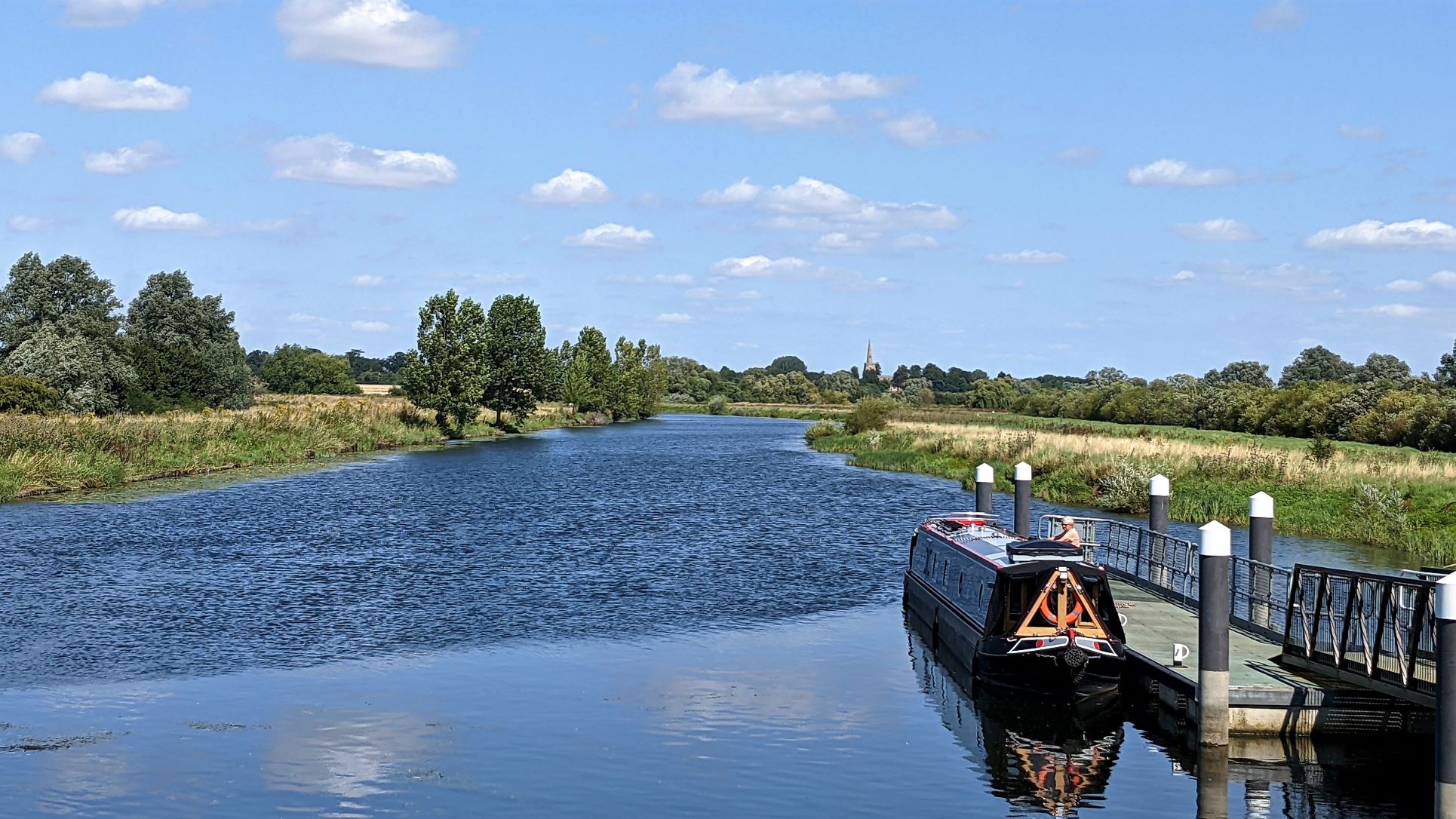
View Back Down The Great Ouse From Brownshill Staunch
This tidal stretch runs up to Brownshill Staunch, another big weir with a lock beside it. This one is unmanned but like the last two, the lock chamber is very long and we needed to work out how best to secure the boat, with only one person on board, before the water starts pouring in. Here at Brownshill it seemed to work alright with Sue holding a centre line looped over a bollard on the lock side.
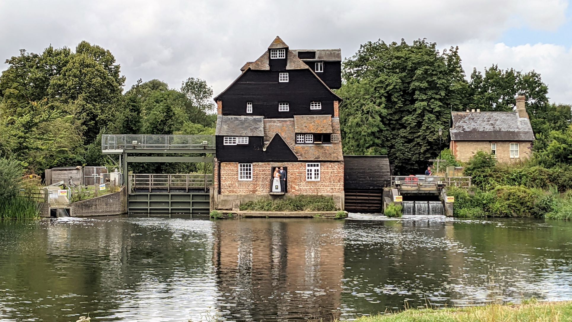
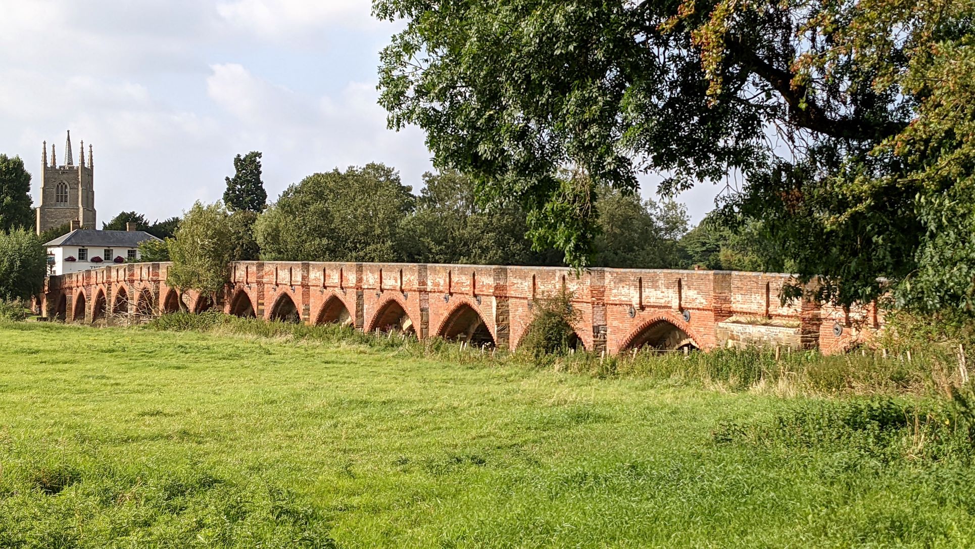
We carried on up to St. Ives Lock, where things did not go quite so well. Firstly, we had not appreciated that this was a 'D' shaped lock and what that entailed. Effectively, it means that there is a cut-out in the lock side that is large enough to accommodate one boat. It is possible, therefore, to fit three quite large boats in at the same time. We arrived at the lock landing and before we could think about what was involved "Plan B" arrived, a large cruiser. They went in and occupied the 'D' section and we came in after them. We got the centre line looped on and back to Sue, at which point someone who had arrived and was waiting to come down the lock threw open the paddles on the top gate as fast as they could. The rush of water coming in set our boat surging around in the open lock with Sue hanging on for dear life. In the end, the current was too strong and she had to let go leaving the boat to bob about out of any control. Fortunately, by then, the lock was partly filled and there was no real harm done but it was alarming.
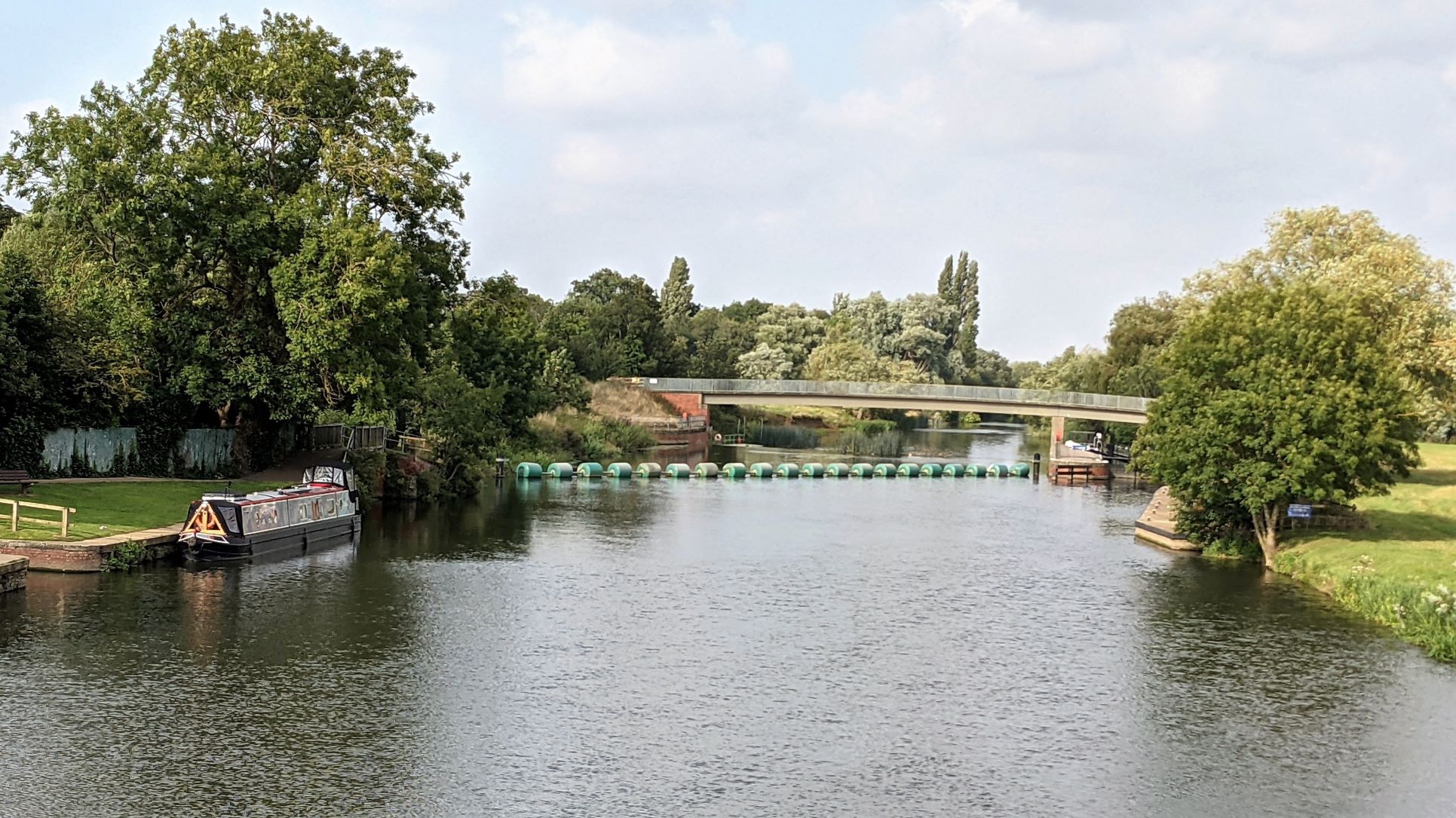
Having caught our breath we carried on to the Town Quay at St. Ives, which was full and then, avoiding a head-on collision with another narrowboat coming downstream, at speed, through the single navigable arch, we passed through the bridge and checked out The Waits mooring. This is a single channel with space for five or six moored boats on the right and for one boat to pass alongside them. I had not done enough research for this part of the trip and didn't realise what we were getting into. All the spaces were full, most with their crews on board drinking in the sunshine and a variety of alcoholic beverages. Interestingly, no-one thought to say anything as we glided past. I hoped that the channel would go straight through and back out onto the river. In fact, it was a dead end, although the map did show a winding hole at the end. When we got to the end, however, the space that was probably intended for this purpose was more like a swamp. Overgrown with trees, silted up with very obvious mud banks and impeded by a sunken boat, loosely tied at the side, there was no way to turn a sixty foot narrow boat there. We had no alternative but to start reversing up the way we had come, past all the moored boats, including one wide beam. It went surprisingly well, helped by being in the lee of a large stand of trees. There was one tricky moment as we cleared the channel and were suddenly exposed to the full force of the wind but we had cleared just enough room to be able to use more power from the engine to exert some control.
There were two other moorings in the town and we could see they, too, were full but the GOBA came to our aid. They had established a site on the river bank, outside the town but just a few hundred metres upstream. This was busy too but we managed to find a space to squeeze into. On foot, just across the meadow, there was a path back into town, which was only a ten minute walk.
Having lived in this area for a few years, a long time ago, it was interesting to see the town again, with what was familiar and what had changed. We stopped off at Floods for a drink before dinner. This used to be quite the place to go in St. Ives, with a popular bar downstairs and a very nice restaurant above. It is rather different now and it is hard to judge how much to attribute to the impact of Covid and how much to a general decline. I enquired about the restaurant and it is still up there but only opens up on weekends. The downstairs space was filled with tables with chairs stacked up on them and was clearly not in use. Outside, they had established a temporary bar area and opened up a terrace down to the river wall, which was quite pleasant in the sunshine. Less pleasant was standing, trying to order a drink from the barmaid, while another staff member stood beside me lobbing bottles over my shoulder into a bottle skip behind the counter. Those that landed made plenty of noise but not nearly as much as at least two that missed. A venue no longer on our recommended list!
Pastures Old
From this point we would be travelling through an area that we should be expected to know well. We spent about seven happy years living in Godmanchester, near Huntingdon. Most of the places we would pass through, now, would be considered local, at least as far as St. Neots. We thought it would be interesting to see how much things had changed. In practice it was almost more interesting to see how little we remembered or how different things seemed from the perspective of the river.
Leaving St. Ives the next stop was The Hemingfords, one lock and less than an hour up river. Fine, dry weather continued but the wind was stronger than ever. There is a town quay at Hemingford Abbotts, which is actually quite sheltered. However, when we moored up there, we found that it was very high. A real scramble up via the roof to get on shore and quite a rough concrete side for the paintwork. Just beyond there was a GOBA site along the meadow between the two villages and we moved up there. It was a mooring that suited us better and there was a space available but it was very exposed. Approaching the mooring we were blown right over on to the far side and had a bit of manoeuvring to get across to the bank in a lull between gusts. Having managed to get onshore with a centre line I would normally pull the boat in to the side for Sue to then hold while I put in the pins. Here, with nothing to secure it to, I couldn't even hold it on my own. Even when Sue got off to help, we could hold it where it was but just couldn't bring it in to secure it. Another boater sitting near by came and gave us a hand. With his help we got the boat alongside and I was able to get it pegged in but it was an impressive demonstration of the power of the wind.
Hemingford Abbots and Hemingford Grey are two small villages adjoining along the river between St. Ives and Huntingdon. When we lived up here we would walk along the river past them and admire the pretty, unspoilt cottages and larger, grander houses of what were two of the most expensive locations in Cambridgeshire. One of them was regarded as being superior and more exclusive than the other but that was only a question of degree. At this remove, I can no longer remember which was the poor relation to the other and with fresh eyes I could see very little to set them apart.
A stroll around both settlements later in the afternoon showed that they were as privileged and chocolate-box perfect as ever. There was a little extra development around the edges, perhaps, but no acres of new housing estates. In the older parts, down towards the river, every property was pristine; well-maintained, smartly decorated and tightly clipped. As I passed one house, there was a lady out on the front lawn tidying up some blemish, invisible to the untrained eye, with a dustpan and brush. Each village has its pub and each was fully operational with prices clearly reflecting the wealth of the inhabitants. At The Cock, for example, nine pounds for a perfectly ordinary fish finger sandwich, however elegantly described, seemed excessive to the point of extortion. Needless to say, we passed. However, we did go across to the Axe & Compass in Hemingford Grey for a drink in the windy sunshine.
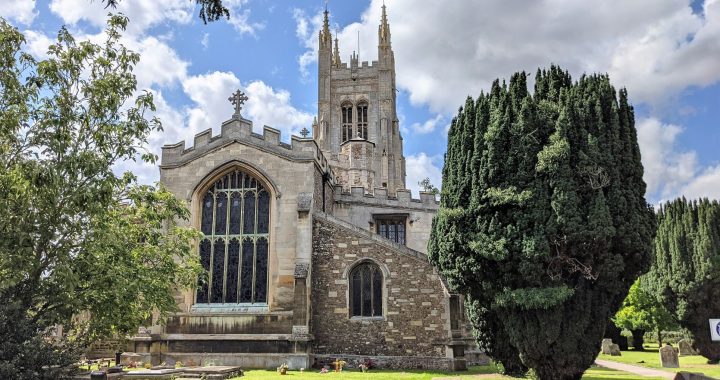
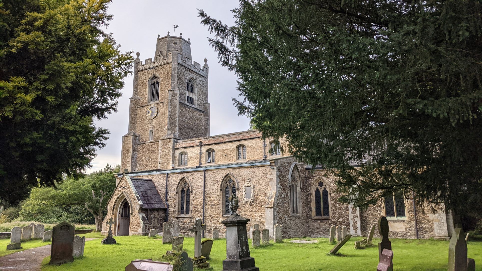
Hemingford Abbots and Hemingford Grey - two of everything, including churches
But Which Is Better? - Only One Way To Find Out . . . .
The next day promised the same high winds so we decided to stay put. We went for a long walk across to St. Ives and around on the other side of the river to return across Houghton Lock and the Black Bridge. We had a longer look around St. Ives and the mix of the familiar bones of the place, overlaid with thirty-five years of modernisation and growth was really quite strange and disconcerting. There is no doubt it is now, as it was then, an attractive little town to live in but it is much livelier now, with a lot more bustle and a catalogue of High Street names that we once would have expected to have to go to Cambridge to find.
The old path that runs above the river all the way to Houghton is now clean, dry tarmac all the way. We took a footpath off that which follows the actual river bank, no doubt prone to flooding in winter but quite dry, if a little overgrown, in August. From the bank you can get a different view of the Hemingfords and it brings you out at Houghton Mill. A mill stream runs off the river and the mill stands over it, of course, with the village a few hundred yards inland. It is a fully restored, eighteenth century, flour mill now owned by the National Trust and there is a large car park and picnic area as well as a café. Lots of people use the water downstream from the mill for canoeing and paddle boarding and Houghton Boats are on hand to hire you a canoe, punt or rowing boat. While this was all open and busy we were surprised to find that the mill itself was closed, due to a private function. It seems it had been hired out for a wedding party. We hadn't realised the NT did that sort of thing but I guess they are desperate to find new revenue after COVID. I am not sure where that leaves the members, who have paid their money for free entrance already, in the pecking order.
Houghton Mill - Now A Wedding Venue
A look around Houghton and the neighbouring village of Wyton was interesting as well. Although it was only two o'clock on Friday afternoon it was very busy and at the Three Jolly Butchers in Wyton they were turning people away, even if they just wanted a drink. There wasn't quite as much change as in St. Ives but it certainly seemed livelier than we remembered with facilities that never existed when we knew them.
St. Neots - Imported Affluence
The next town on our route was St. Neots. This was on the outer limits of our familiar area from Godmanchester. Again, the river hardly featured in our thoughts in those days and as a town our recollection of it is one of its being rather shabby and uninteresting. The name is a great example of religious shenanigans in the early middle ages that would leave today's 'villains' in Financial Services in awe. Leofric, a local landowner in Eynesbury, established a Priory that had the potential to generate considerable income from the visits and donations of pilgrims. However, to attract pilgrims they needed relics for them to make a Pilgrimage to. Leofric arranged for the bones of Saint Neot, a much-revered Saxon monk who had spent his life in Cornwall and been buried there, to be exhumed and brought to Leofric's new Priory. This had the desired effect and the Priory became a major centre of attention for pilgrims and financially, very successful.
Arriving by water, while we were presented with some challenges, it was definitely more attractive with the river being quite wide and passing through the town bridge with the Priory Centre on the town side and a large park on the left bank. It probably just looks better from the river but it has also definitely had some investment in the landscaping and activities in the park. This was very well used and a small orchestra gave an open air concert during the afternoon that a lot of people seemed keen to attend.
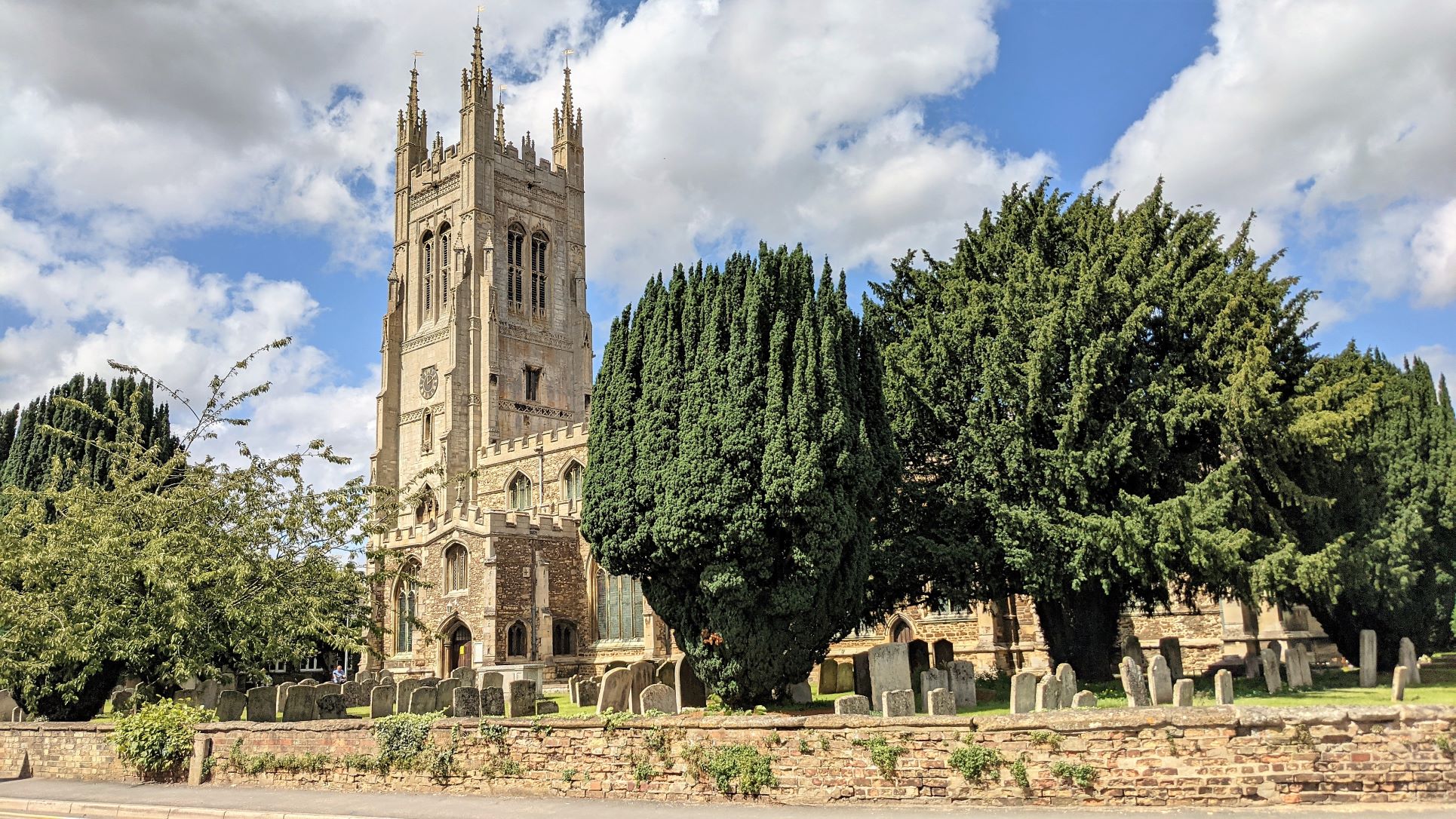
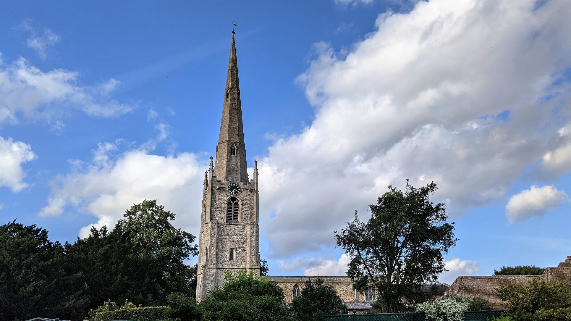
St Neots Church
We approached St. Neots aware that mooring spaces were limited and more nervous given our experiences in St. Ives and elsewhere. Being a Sunday and reasonably fine we expected to find a lot of day trippers out in their boats for starters. We first hoped to moor a little short of the town, where there was a stretch of council mooring with an open field behind. The mooring was there, clearly marked as such but an angling club had set up shop along the bank, with a fisherman every couple of yards and clearly running a serious competition. Perhaps we should have forced a confrontation but we decided to just move on further towards the town.
There is a pontoon outside the Priory Centre that will take three or four narrowboats and also has the only water point but this was already full. There were a few boats moored on the opposite bank and we went to see if we could join them but found the river bed shoaled badly behind the boats that were there and we couldn't get alongside.
The only other mooring site was through the bridge against the park bank. We crept through and could see that the straight bank available there could take a couple of boats at best and two cruisers were already in place. However, the bank curved round under that side of the bridge and we just managed to reverse into the spot and put our pins in the grass. It was a relief to have been able to find a berth but the difficulty of doing so, especially in town settings, was beginning to make us anxious about what we would find every time we set out. It doesn't add to the enjoyment of the trip.
We had intended to continue on to Eaton Socon where there was access to a large supermarket. However, with concern over getting a mooring on the limited space there, we decided to do the shopping in St. Neots and stay the night here, which would give us time to have a better look around. We tried the Priory Centre, the Tourist Information office and the Library but they were all closed, so we ended up downloading a guide from the internet blog of someone who had visited the town themselves. It wasn't ideal but it gave us a route to follow that would cover most of the ground. We didn't find much to get excited about and found the High Street to be really crowded but we did feel the town was rather nicer than we remembered and could see that it had had some investment. The market square was really quite big and it would be interesting to see it on an actual market day.
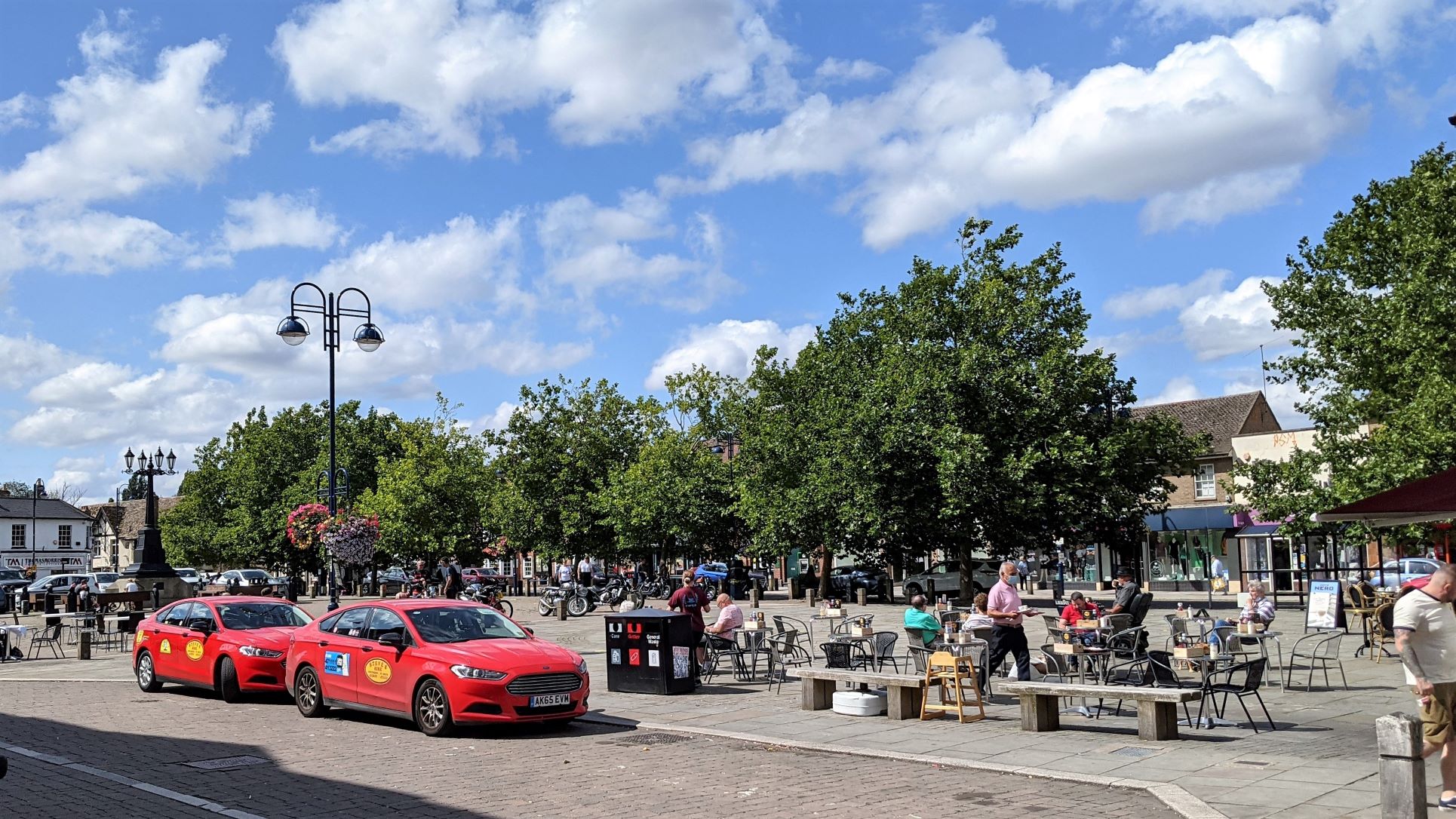
A very substantial Market Square
One interesting feature we came across was a mosaic in the little Jubilee Gardens beside the bridge on the town bank. It was originally created in honour of the Queen's Golden Jubilee in two thousand and two. As it was about to be installed concerns were raised about the suitability of the adhesives used in conjunction with its intended location so close to the river. The installation was put on hold and the mosaic placed in storage at the firm of a member of the Mosaic Committee, where it lay, forgotten and gathering dust, for seventeen years. A local councillor became aware of its existence and located both the mosaic and the original artist. Suitable materials were able to be identified this time and it was finally installed in two thousand and nineteen. A long wait but a good outcome in the end.
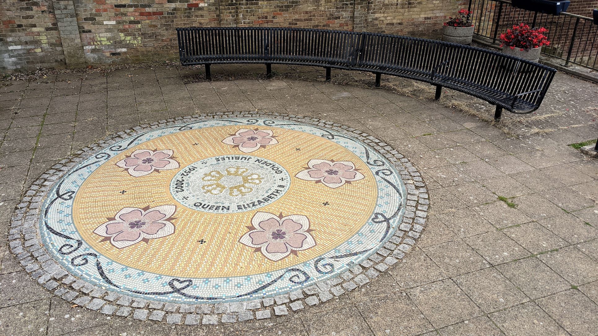
The 'Missing' Mosaic
Great Barford Bridge
Monday came with cloudy skies and a return of some seriously high winds. Having checked that the water point was now clear, we had to do a U-turn, dive through the bridge and would have to turn again and go back up through the bridge once we had filled up. In the end the more challenging obstacle was the huge willow tree planted just in front of the pontoon. It was a short jetty with two plastic boats already on it, so coming in completely blind and crouched down to try to get under the branches was not helpful. We managed to stop in time and ended up chatting to a guy called Steve from "Dodgy Dame". He was already using the water tap but insisted we use his hose once he finished to save getting ours out. While we waited another narrowboat arrived and had real difficulty with the wind so that a couple of us had to lend a hand, which made us wonder how our next pirouette would go. There was plenty of width in theory, compared to our boat's length but if you need to use a lot of power in order to overcome the force of the wind you can often find yourself approaching the opposite bank much sooner than you expected. Happily, we made it round with plenty of room to spare and with room to get back under the bridge heading upstream.
We had a little bit of rain and for one reason or another there were delays at a couple of the locks so we arrived at our day's destination shortly after lunch. The sun was starting to come out, there was space to moor and we had a good view of Great Barford's key attraction, which is a Grade 1 listed, fifteenth century and very picturesque bridge spanning the river. The moorings are on a green beside the river that has a water point hidden in the trees about ten yards from the bank and a slipway half way along the mooring area that awkwardly divides the available mooring space in two. The Green is just across the road from the Anchor pub and with a broad area of water formed between the lock and the bridge, this is a very popular place for people to indulge in paddle boarding, canoeing and wild swimming, as well as just wandering around and sightseeing. It was certainly very busy on a Monday afternoon in August but it has to be said that it is also very well maintained and scrupulously clean and tidy.
Great Barford Bridge
and the lagoon formed with the weir
Once we were settled in I went for a walk across to a place called Blunham. It had a nice looking church but little else to hold your interest and the route back across open fields was now burning hot, so a cool pint at the Anchor Inn was definitely called for. It seemed a nice place and we decided we would return here for a meal on the way back.
The clear afternoon led to a cold night, made more dismal by a couple of hours of very heavy rain from about seven o'clock. We let it clear and got on our way for today's last leg into Bedford. We usually try to avoid going inside marinas just for services. They are generally awkward to navigate, difficult to turn in and tend to have a force ten gale blowing across them at all times. As there are no services in Bedford at all, we would have to stop at Priory Marina, which was not on our list of marinas with bankside service quays, for fuel, water and a sanitary station. For once, though the day remained cool, grey and damp feeling, at least the wind had dropped and so our stop-over was relatively trauma free before we set out after lunch on the final leg to Bedford.