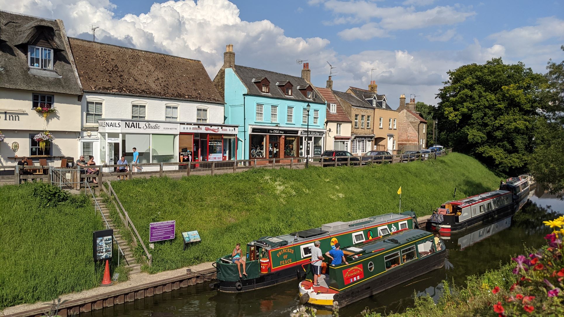
Wandering Round Whittlesey
The mooring is beside the Manor Field recreation ground, which runs all the way up to the lock and the road that crosses beyond it. The space seems extremely well used. It has a big leisure centre, very busy skate park, outdoor multi-use courts, all quite active, as well as being popular for picnics and dog walking, with a path all the way along the river bank. Another path runs all the way along the other side of the river that is also very heavily used by dog walkers. The regular exchange of greetings and gossip across the water, often over the roof of our boat, was a real feature of our stay, less welcome in the early morning than it had been the previous afternoon.
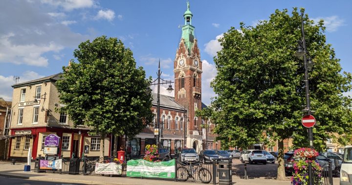
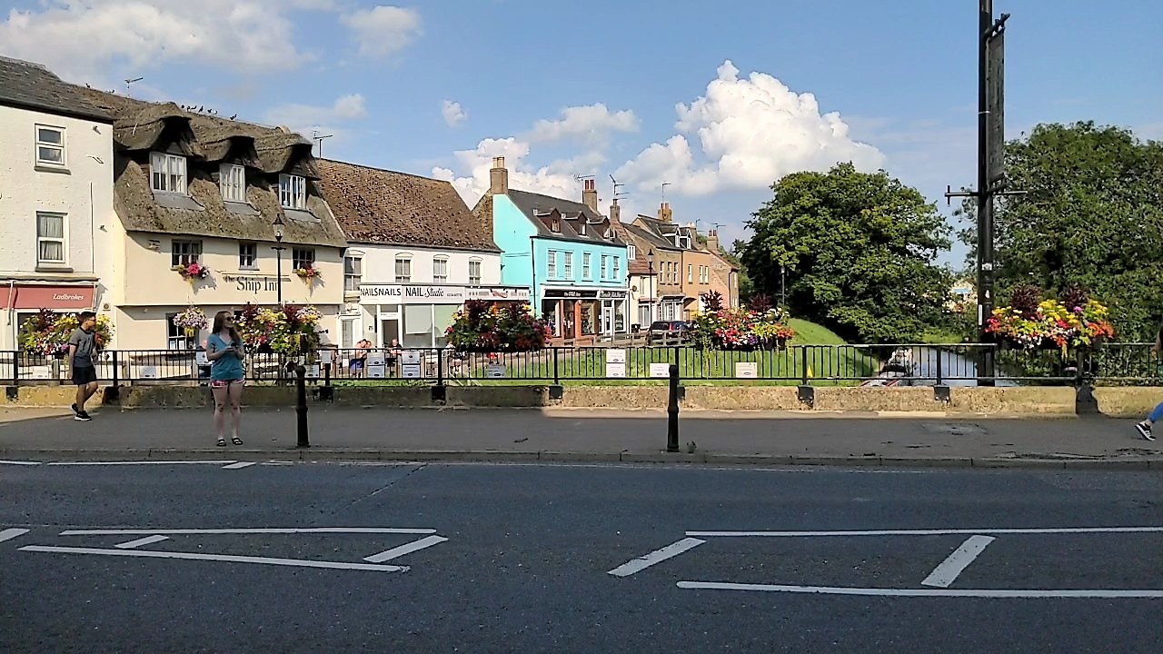
The recreation ground is completely separated from the town so there is no choice but to walk right across to the main gates and then follow the road into the centre, which is only about ten minutes walk. The centre of the town is the Market Place dominated by The George, the local Wetherspoon's and by the distinctive Butter Cross, a 17th Century open Market House. The George was doing a roaring trade at three o'clock on a Tuesday afternoon, which was a bit surprising.
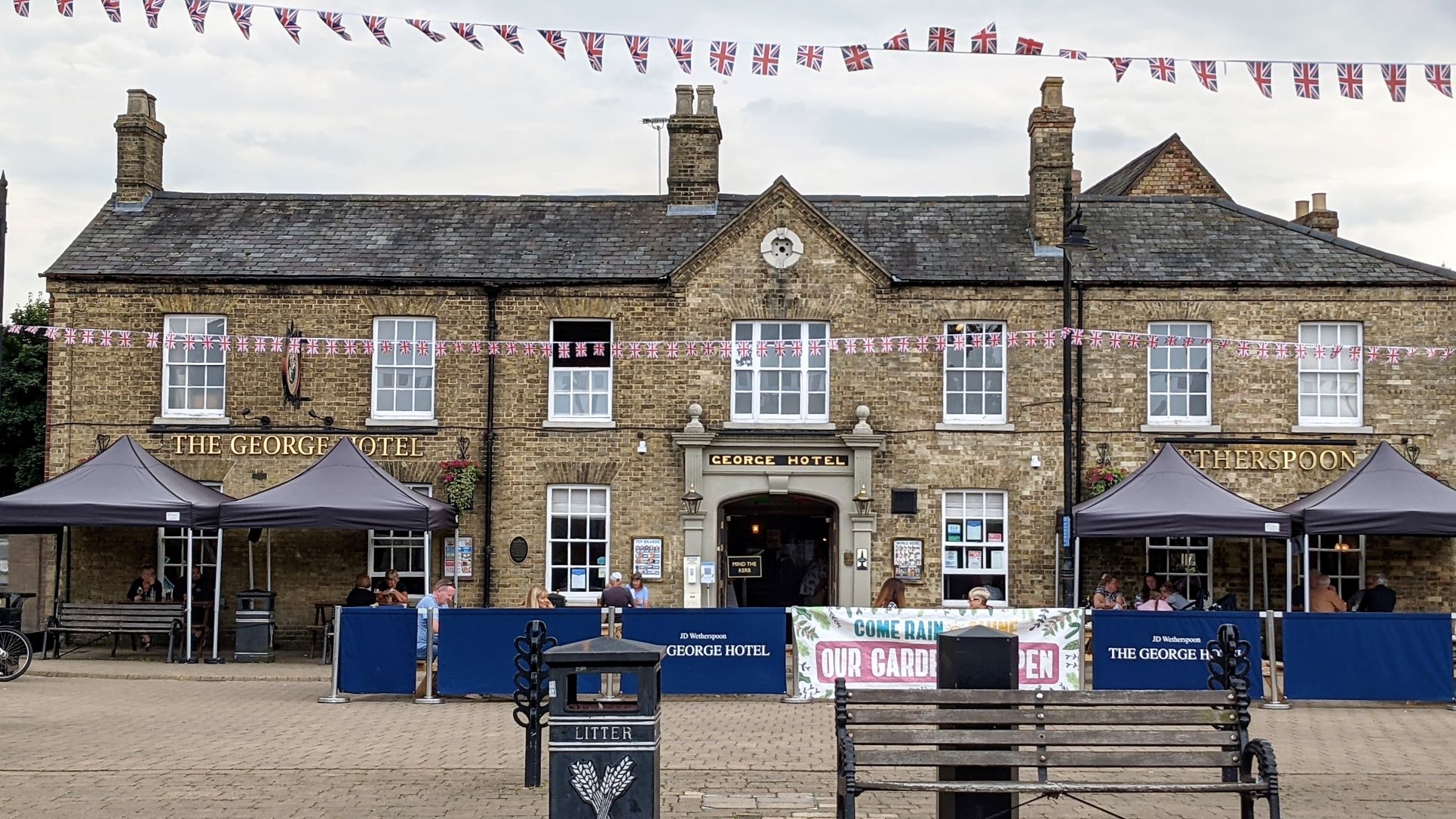
Busy Tuesday afternoon at The George
Initially we thought the Butter Cross was slightly spoiled by the three women sitting in it and shouting out at full volume across the square to anyone they thought they recognised. On reflection, though, three old crones, knitting and nattering in the Market House, whatever the weather, was probably quite authentic.
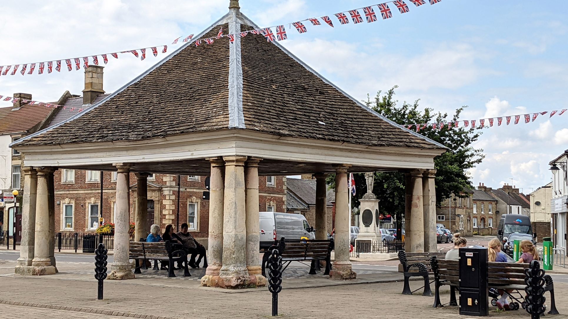
Butter Cross in the Market Place
We'd found a town trail on the internet, which we followed for a couple of hours. The trail highlighted various interesting buildings and one particular feature of several, which is 'tumbled' brickwork on the gable ends. The bricks are laid at right angles to the slope of the roof, which gives quite a nice finish but seems to be purely cosmetic. Overall, it seemed like a nice little town. The area that seemed most run-down was the modern pedestrian precinct, opposite the Market Place, called High Causeway. Here we saw a lot of closed shops, some of which had actually relocated to sites close by but away from the precinct, everywhere else seemed to be doing OK.
Marching On
Setting off the next day we were straight into Ashline Lock, one of those requiring the special windlass purchased the day before. This dropped us down into Whittlesey Dyke, which carries the link route as far as Flood's Ferry where it joins the old course of the River Nene. The link route then uses the River Nene old course into the town of March and beyond, passing junctions with Twenty Foot River and Bevill's Leam. You are hard put to tell the difference in the landscape, the phrase 'dull as ditch water' must have been coined when travelling these artificial drainage channels through the wetlands. By now you are looking for any distinctive landmark to relieve the monotony and indicate that progress is being made, such as the marker installed by the Round Table where the Greenwich Meridian crosses the river.
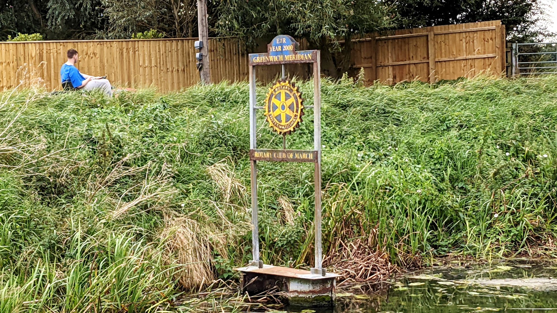
The Greenwich Meridian - Anything For Some Interest
With no public mooring in between, we had no choice but to carry on for about four hours to reach March, the only other real town in the levels and quite a bit larger than Whittlesey. As you approach March you pass some very modern and expensive looking offices that house the Middle Level Commissioners before passing Fox Narrowboats. Fox seem to have it all sewn up in this area. They are the only place to get fuel, are the only real hire base, provide temporary and permanent mooring and also offer all kinds of boat repair and maintenance services. Once past the marina, there were boats on private moorings all the way into March on both sides, which slowed us down, until we entered a cutting to reach the visitor moorings in the town.
There are three thirty-six hour mooring sites. The first was roped off as it had largely collapsed into the river.

Collapsed Mooring In March
The second, just before the Town Bridge, we stopped at briefly while we checked out the final site, just the other side of the bridge. This second mooring was permanently shaded by trees, carpeted in goose droppings and overlooked by a quite raucous crowd gathered on the grass outside the Acre Pub. Being a fine and sunny afternoon a range of ne'er do wells had obviously started early on their Wednesday afternoon refreshments. Thankfully, we found there was space on the final site and were able to move up there. This one was long enough for several boats and was in the sun. It was still in a cutting and the Ship Inn was at the top of the steps but it was fenced off from the road above and everything felt a lot more open.
Final Resting Place In March
Someone came from the boat in front of us to help us get in and tie up. This turned out to be Mark Hockley, someone whose exploits we had been following on YouTube. He and his wife had moved onto a boat for the first time around the same time we acquired ours, so we had found their regular video diaries quite interesting. It was a strange experience to meet he and Debbie in real life. They have shared so much of their experience on the boat and the incidental circumstances and traumas around it, that you feel you really know them well. For their part, they don't know you from Adam and have no idea where you come from or any of your background. I am sure that part of what has made their channel popular is their ability to greet total strangers like old friends and we enjoyed a chat with them without any real awkwardness.
We didn't have time for a proper tour but we did have a walk around the town in the afternoon. March seems busy and active but a bit weather beaten. It doesn't feel prosperous like Thrapston or Oundle but it doesn't seem run down and depressed like Wellingborough. It does have the type of shop you would never have believed still existed.

Computer Shop From the 20th Century
Down by the river, with the sun shining and the pub customers leaning on the rail there was a bit of a seaside feel to the place.
Seaside Feel in March
As well as The Ship, the row of buildings above us included an American diner and the fish & chip shop we had been urged to try by the people we met in Peterborough. With classic timing, however, there was a sign on the door that, due to unforeseen circumstances, they would be closed today. They also intended to close from seventh August through to the third of September so it seemed likely we would never sample their wares.
Time and Tide . . . .
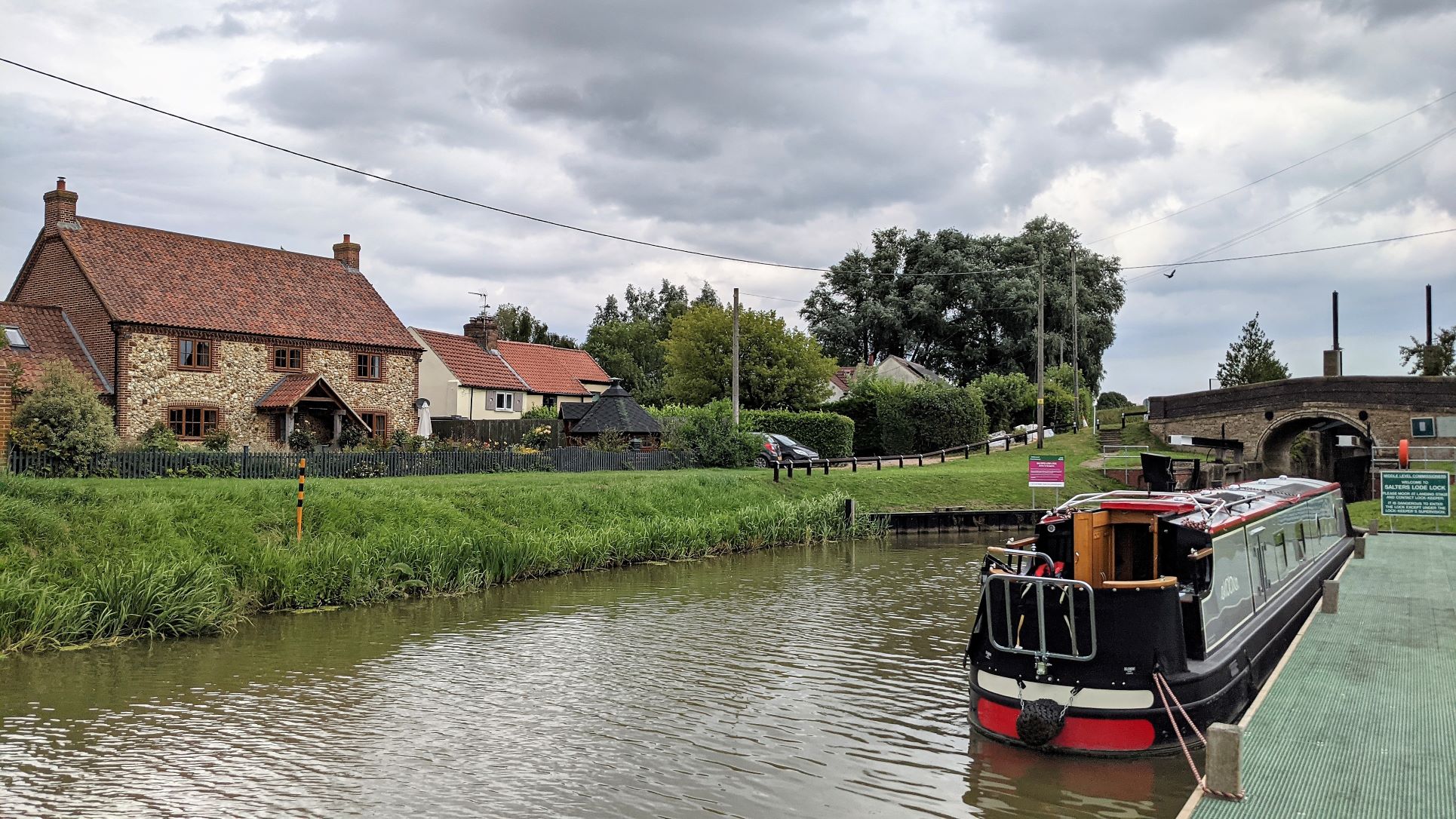
The lock at Salter's Lode is manned by the Middle Level Commissioners. It provides access to the tidal Great Ouse, flowing past towards The Wash. Passage is only possible at certain times either side of high tide. There are tables for the times of the tides that also show whether they are neap or spring tides. The latter are stronger and higher, so a neap tide presents the easy option. When we had been planning this part of the trip we had realised that the last such tide, for a while, was today, so we were keen to make the crossing.
Once on the Great Ouse, in order to get to Bedford and Cambridge, there is an option to continue straight up the New Bedford River, also known as The Hundred Foot Drain, I think because it was dug to be a hundred feet wide. We had briefly considered taking this route, in one direction or the other. The channel remains open to the tide and is notorious for the appearance of sand banks along its length, which, in any case, is nothing but twenty miles of hundred foot wide, straight ditch so we had decided against it.
The alternative, and the one most people take, is to travel a short distance up the river to Denver Sluice, where Denver Lock is operated by the EA. The lock keeper at Salters Lode liaises with his colleagues at Denver Lock to co-ordinate the locks opening and closing based on the number and type of boats that are ready to cross on that particular tide.
Today, high tide was to be at half past four, although there is some variation and we had been told it would probably be a quarter to five before the lock would open. As well as having to notify the lock keeper in advance, there were a lot of safety warnings regarding the tidal crossing including a requirement to wear life jackets, have your mobile phone fully charged and your anchor at the ready etc. The instructions also warned of the sandbank immediately outside and to the right of the exit from the lock, which forces you to go out across the channel before turning into the current if you don't want to be beached.
The time-critical element, with all the warnings and special requirements, built up the anticipation nicely. We were ready to go by a quarter past four, aware of the old wisdom that time and tide wait for no man.
Waiting For The Tide At Salters Lode
This may be true but it appears that man waits for the tide, regardless of the advertised tables. Our lock keeper advised that it was coming in very slowly and it would be some time before conditions would be right. In the end it was an hour after the original time that a sudden flurry of activity had us in the lock and hovering outside the exit doors, while the lock was raised and lowered again for another boat. However, we were still not given permission to go. There were three large sea-going cruisers coming down from Denver Sluice and heading for The Wash. They get priority and we were obliged to wait.
How long does it take them to get from Denver Sluice and how long have we got before the tide turns against us were critical questions that occurred to us as the minutes ticked by. In fact, the cruisers were told to go slowly past the lock to avoid too much wash for us and as they passed, one at a time in single file, the power would suddenly be applied and the craft be unleashed to continue at full speed. Quite a sight.
At last we were given the go-ahead for what turned out to be a bit of an anti-climax. The sandbank had been dredged in the winter and so was a bit less of a problem, in this direction at least, the turn was straightforward and our passage through Denver Lock, back onto non-tidal waters, was all over in no time. Fifteen minutes later we were moored up for the night with the kettle on.