Getting Used To The G&S
The Gloucester & Sharpness Canal was built to avoid the exceptionally treacherous waters of the River Severn below Gloucester, as well as cutting off a couple of very long loops in the river. By creating a safer route for large sea-going ships it was hoped that the port of Gloucester would be able to rival Bristol and provide better access for raw materials into and finished goods out of the Midlands, reducing costs both ways.
From the Act in seventeen ninety-three, many problems with construction and funding delayed the completion of the canal for nearly thirty-five years but it finally opened in eighteen twenty-seven. As a proper ship canal it was, for a time, the widest and deepest canal in the world, able to carry vessels of six hundred tons. Once off the river, via Sharpness Lock, there are no locks along its length until you reach Gloucester Lock, back onto the Severn. It was said to be sixteen miles long, sixteen feet deep with sixteen bridges. With changes over time there are now eighteen bridges, most of which are now electrically powered swing bridges, each operated by a CRT bridge keeper.
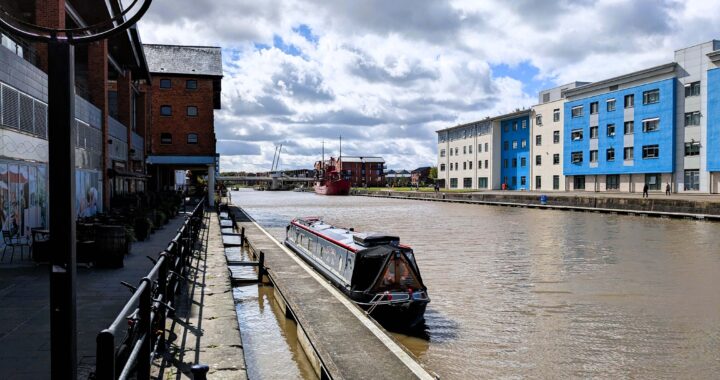
To a narrowboat like ours the canal seems enormous but we rather liked it for its stress-free cruising and pleasant views. At ninety-five feet wide you can turn almost anywhere, the bridges are opened for you and you can moor wherever you want along the towpath. There were plenty of boats, often wide beams, Dutch barges or even larger vessels, moored along it, usually clustered around the bridges but with very little in the way of moving traffic.
Narrow Separation From The River At Sharpness
On Tuesday, third September, a rather dull, grey morning, we made a slow start. There was quite a lot of laundry to do after our stay in Bristol and it was as well to get that done before going to fill up with water. Soon after breakfast we heard the the sound of some power tools and could tell they were steadily coming closer. It soon turned out to be a ground crew mowing the wide towpath and then strimming along the edge of the bank. The vegetation on the G&S was generally very well under control, which made a pleasant change. It is a two-edged sword, though, as a fine, green, strimmer spray then covers the gunwales and is quite hard to remove.
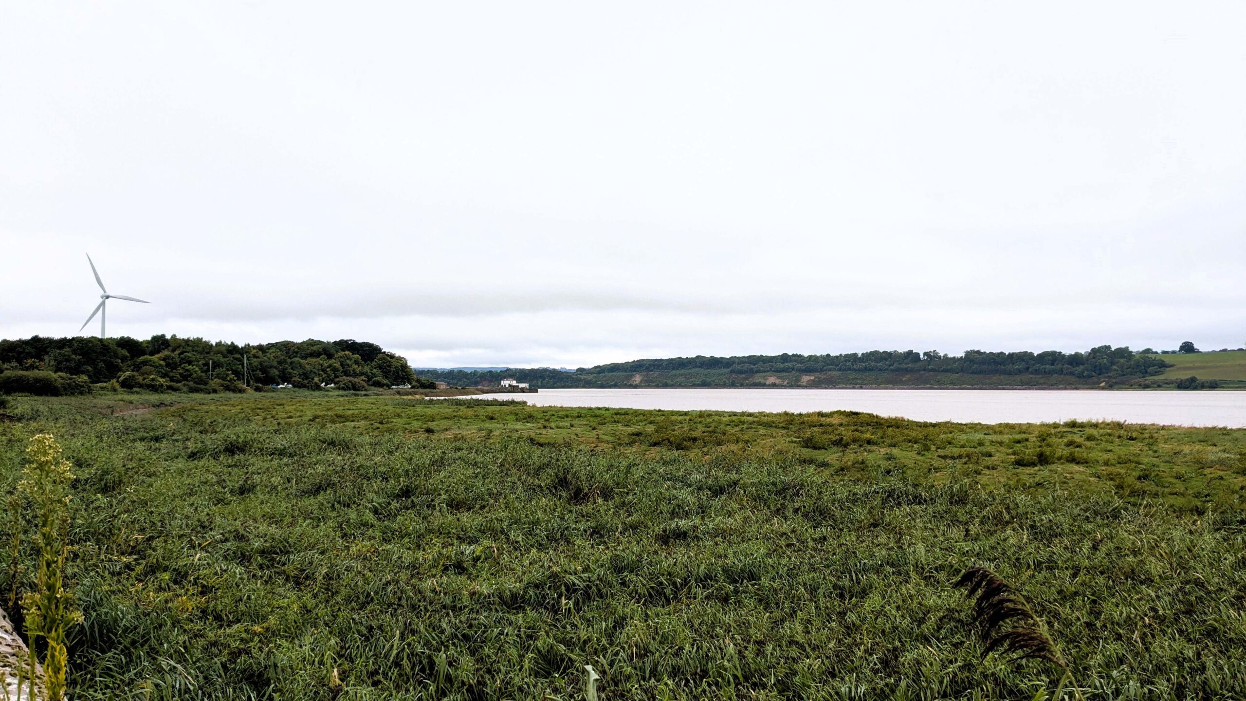
We finally set off about eleven-thirty and an unannounced period of fine drizzle started immediately. It petered out after twenty minutes or so, as we pulled up at the water point and from then on the day began to brighten up a little. This stretch runs very tight along the River Severn so, while the hose was running we had a look around and found a couple of monuments in the bushes.
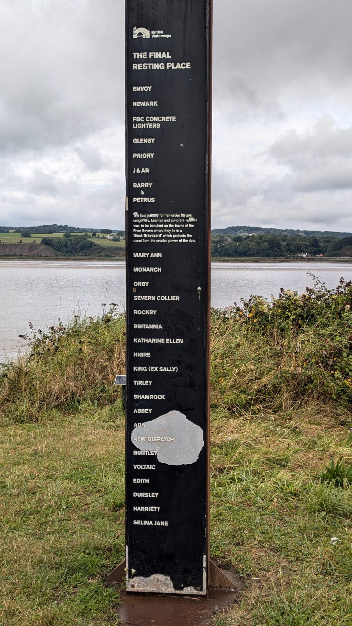
The first acknowledges the eighty or so "Purton Hulks" that have been deliberately beached along this bank of the River Severn, as a makeshift tidal erosion barrier to reinforce the narrow strip of land between the river and the canal. The land between the two is as little as fifty metres wide at this point and following a collapse of the river bank here in the early twentieth century, there were concerns that there might be a breach of the canal embankment. Redundant ships were brought from all over the British Isles, over the next few decades and are now deeply silted over. Some are clear to see and others, barely an outline in the mud.
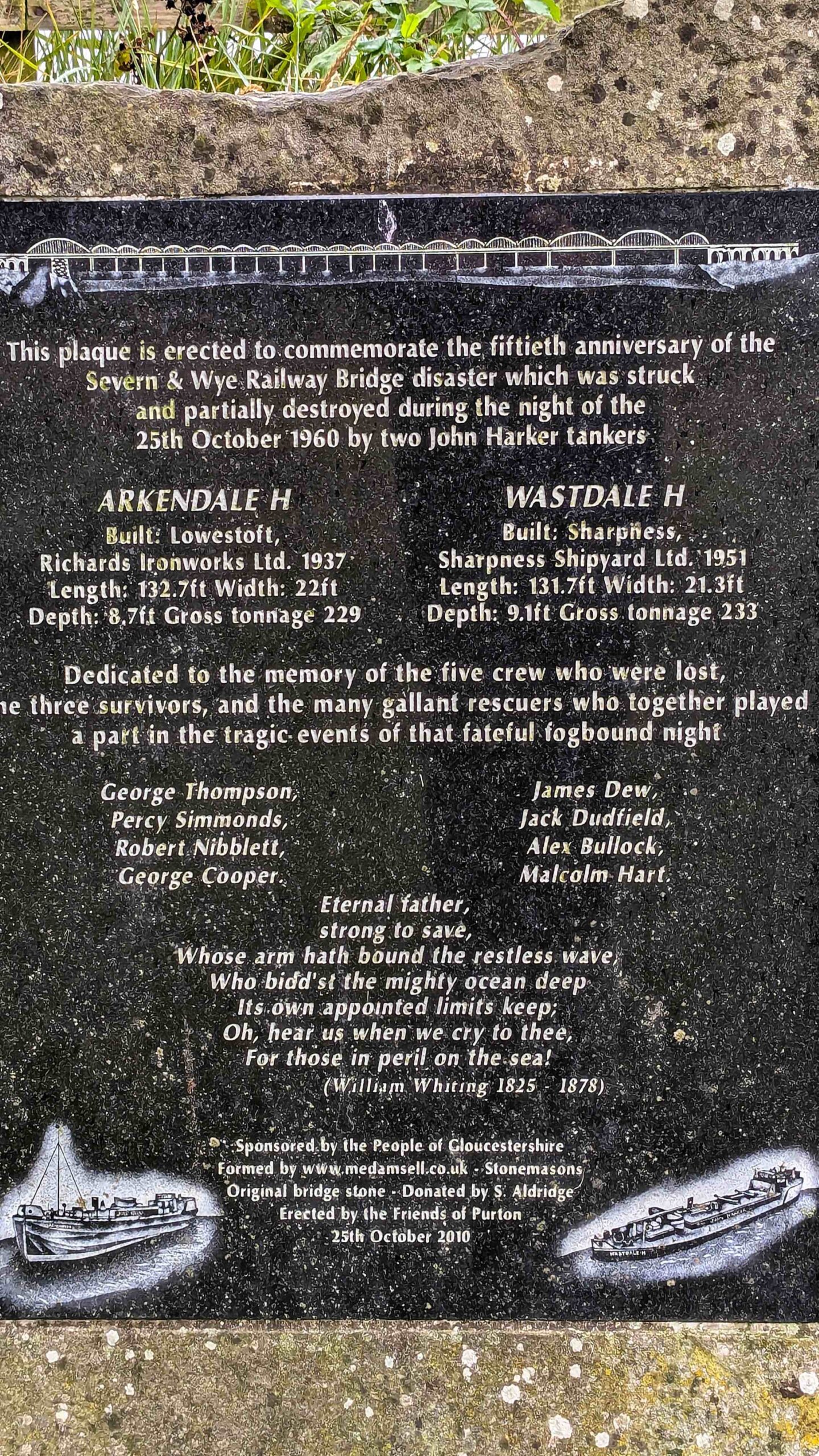
The second plaque is to commemorate the Severn & Wye Railway Bridge disaster in nineteen sixty. Two tanker barges, travelling up from the south to Worcester during the night of twenty-fifth October, were engulfed in sudden fog and came together. They then collided with the old railway bridge, since demolished, with catastrophic consequences, including the deaths of five crew members. Both ships were lost and lay stranded in the mud in the middle of the river. They could not be salvaged and they were eventually scuttled with explosives to prevent them ever re-floating. For a more detailed report you can follow this link: River Severn Tales.
With a full tank of water, we moved on through Purton Lower Swing Bridge. We had contacted the bridge keeper as we set off, so that he could look out for us. It helps if they know roughly when you will be coming and also where you expect to stop, so that they know how far up the chain to inform their colleagues. The movement is controlled by a two colour traffic light system. If the upper light is Red, you cannot proceed. When it starts to flash it means the keeper is aware of your presence and you don't need to do anything else but wait. Green, of course, means that they are happy for you to proceed.
In this case, Upper Purton Swing Bridge, less than two hundred yards further on, is operated by the same bridge keeper from the same control room, so we could pass through both without interruption. Beyond these two bridges the canal starts to move away from the river for a while. We only went as far as Shepherd's Patch and moored up just before Patch Bridge, the next one up. All in all, two miles today, as opposed to yesterday's epic thirty-three mile trip.
In the afternoon, we took a walk down the towpath for a couple of bridges and then on a loop around through the village of Slimbridge and its attractive and imposing, thirteenth century church.
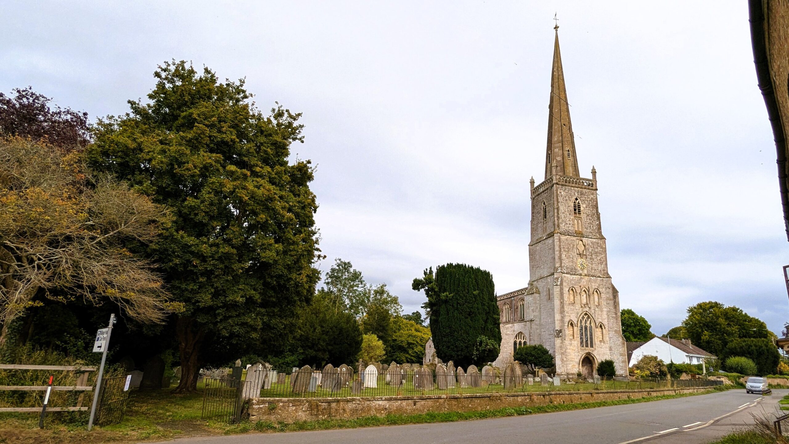
St. John The Evangelist in Slimbridge
The unpromising morning had turned into a fine, sunny afternoon and as we came back across Patch Bridge we spotted "Fair Dinkum", firmly settled in under the traffic lights, on the water and rubbish point there, enjoying a tea party.
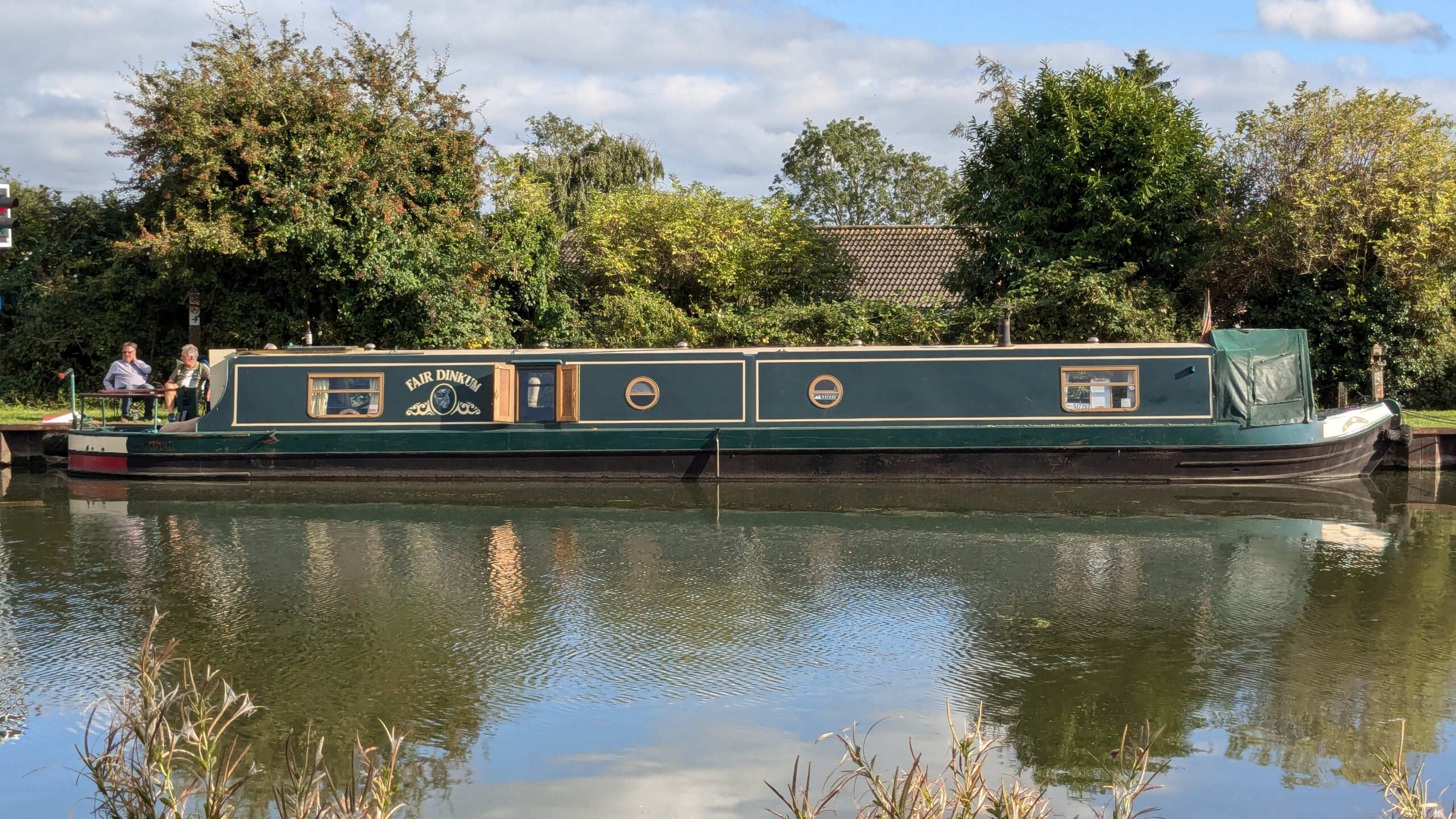
Shepherds Patch Water Point
Saul Junction And The Stroudwater
We had last been home about six weeks ago, so we had decided that we would take a short trip back before leaving Gloucester and starting up the Severn again. We believe we could have left the boat in Gloucester Harbour for a few days if we had spoken to the CRT staff there but in the end we decided we would leave it in Saul Junction Marina.
Roughly eight miles from Gloucester, Saul Junction is about half way between there and Sharpness. It is the junction where the Stroudwater Navigation, which once ran from here to Stroud, met the Gloucester & Sharpness Canal. The Stroudwater is under restoration, with about half of it in water, from Stroud to Stonehouse and real progress being made on the second half. All things are relative, of course. There are some pretty major obstacles to overcome on that phase, so we can only say that we hope it might be open through to Stroud in our lifetimes!
We set off about ten-thirty on Wednesday morning. We rang the bridge keeper and then spoke to "Go With The Flow", who had moored just ahead of us the evening before, to see if they wanted to go through the bridge together. He was waiting for his daughter to return from a walk, so we prepared to leave. All of a sudden, his daughter materialised and there was a sudden flurry of frantic activity that allowed him to set off just ahead of us. That wasn't a problem but we don't know why he was in such a hurry to cast off when he then pootled through the bridge at snail's pace, leaving us to decide whether to just carry on at tick-over behind him or start the faintly ridiculous process of overtaking in a narrow boat.
It was a nice enough day so we settled for crawling behind as we went through Patch Bridge and four more swing bridges beyond that. As we approached Frampton, the canal and river began to converge again as the Severn made a wide meander towards us with The Noose, at the apex of the bend. As the ominous-sounding name implies, the Noose is a notoriously perilous area, full of whirlpools, moving sandbanks and sinking sands.
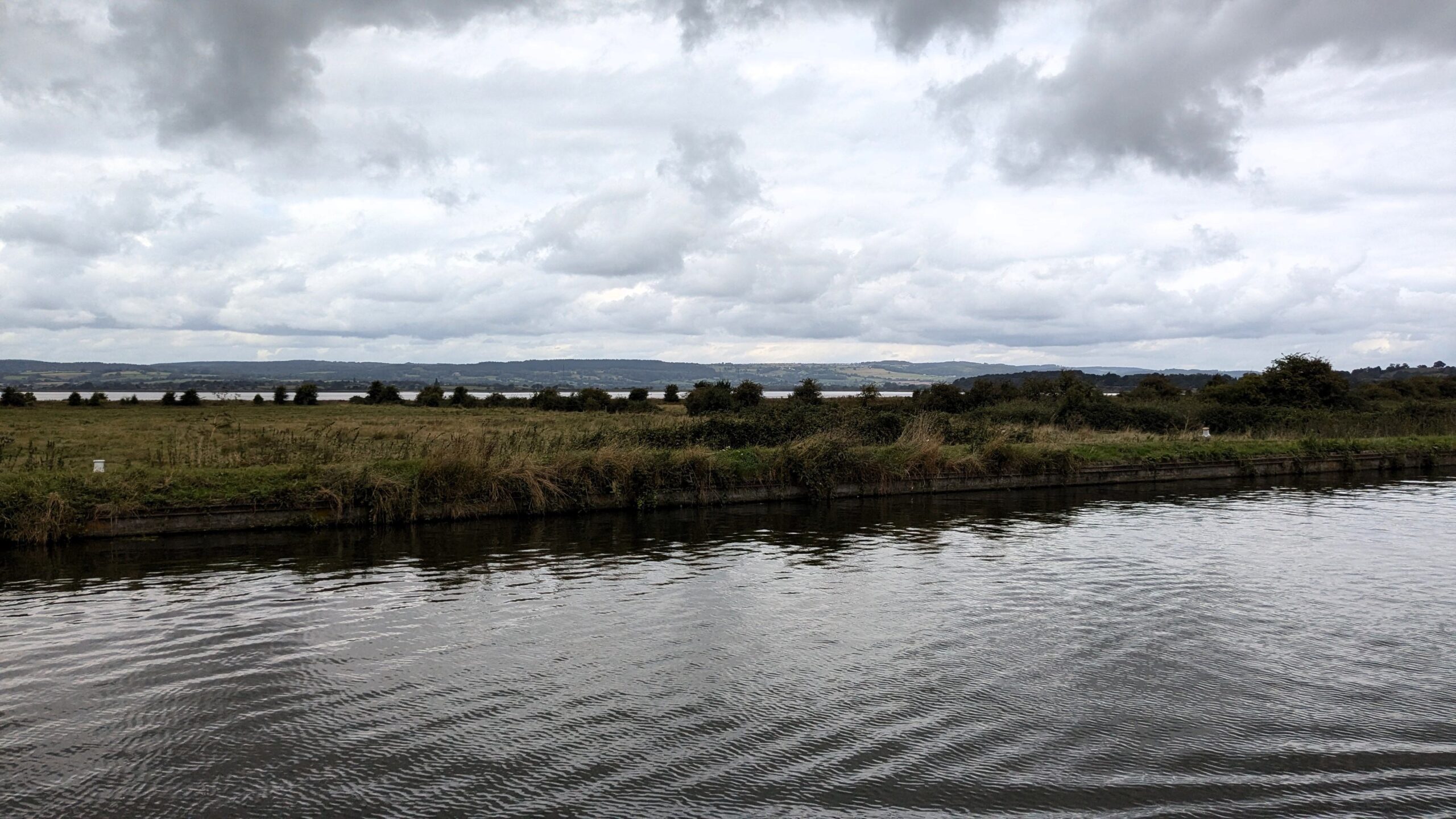
Converging With "The Noose" On The River Severn
We were booked in to Saul Junction Marina, which is a tight, right turn immediately before the swing bridge. We had let the bridge keeper know that we weren't coming through but the junction itself is included in the traffic light control, so we had to wait for the bridge to close behind "Go With The Flow" before we could make the turn.
It is only a couple of hundred yards down the Stroudwater Navigation to reach the entrance of the marina, which presented no great challenge on a fairly still day. The offices and diesel point were off to our left as we entered so we headed straight over there, docking neatly alongside the fuel pump. Unfortunately, we had failed to read the notice above it that informed visitors requiring fuel that they would need to be stern on. We had to back off the way we had come, turn right round and reverse back onto the pontoon. In the end, we were pleasantly surprised at how well that went.
We filled up, booked in and then moved over to our berth, where reversing in went rather less well, as a sudden breeze blew across the water and we struggled to get our bow round enough to straighten up. We did have some help from the guy who had shown us the way, who took a line and helped us straighten up and we were safely tied up enjoying unlimited water and electricity, in good time for lunch.
It was an afternoon of long, sunny intervals, a bit humid but quite warm in the sunshine. We took a walk out of the marina gate and back across the main canal to have a look at the junction and the visitor centre there. It was a short walk from the junction along a footpath to Wheatenhurst, where we found Whitminster Manor House and St. Andrew's church, the parish church of Whitminster. This building is fourteenth century, as impressive as Slimbridge and is in a lovely peaceful setting. However, it is another mile along the footpath straight across the fields to reach Whitminster.
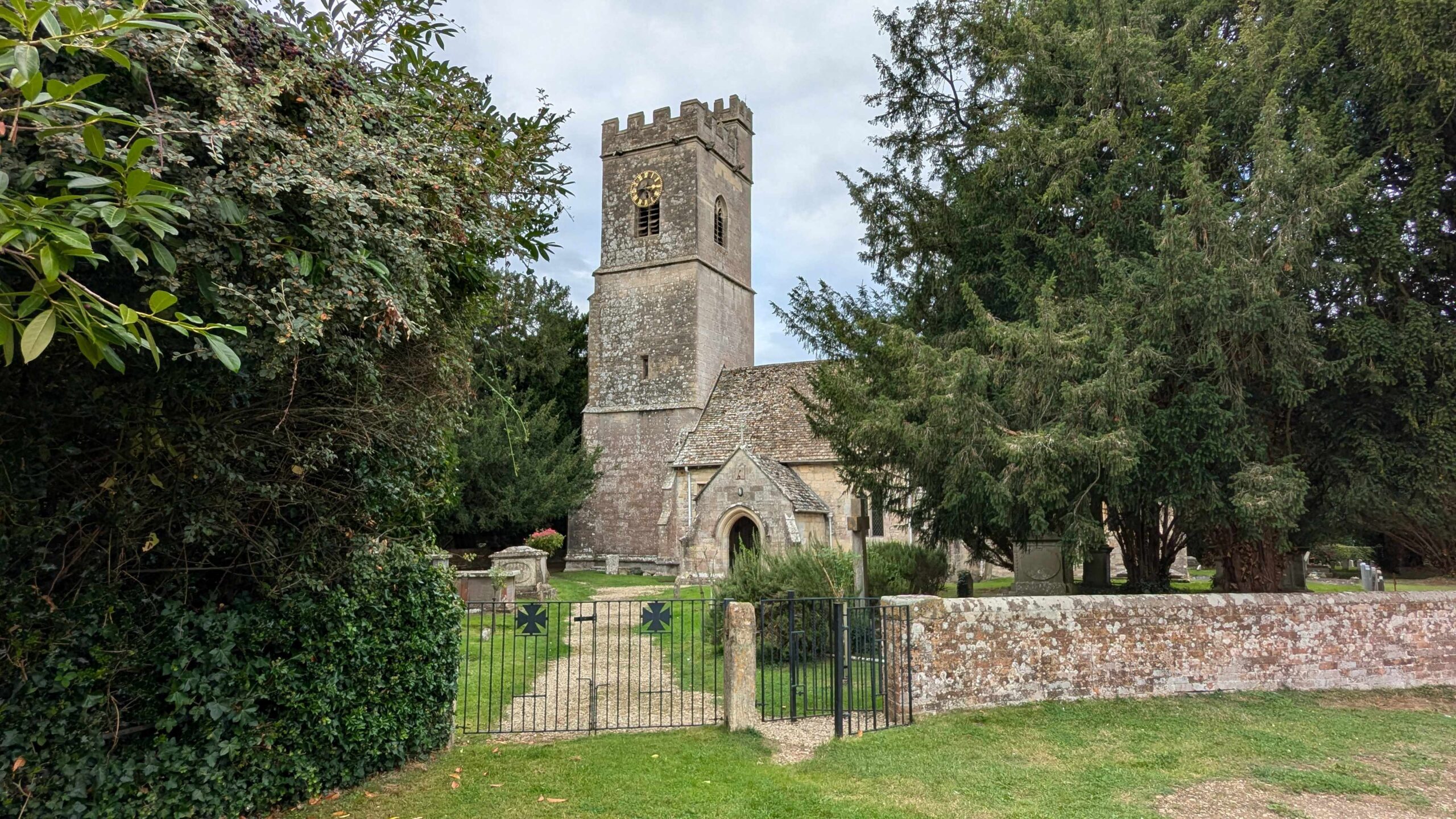
St. Andrew's - the 'local' church for Whitminster
There was no option from there but to walk a short section of the main A38 to the roundabout but at that point, you can pick up the towpath for the Stroudwater and follow it all the way back to Saul Junction. While the canal is non-navigable it is, mostly, clearly identifiable and generally has some water in it. We even spotted an old boat called "Stuart" floating among the trees, although we have no idea whether it is ever able to escape into the wider network.
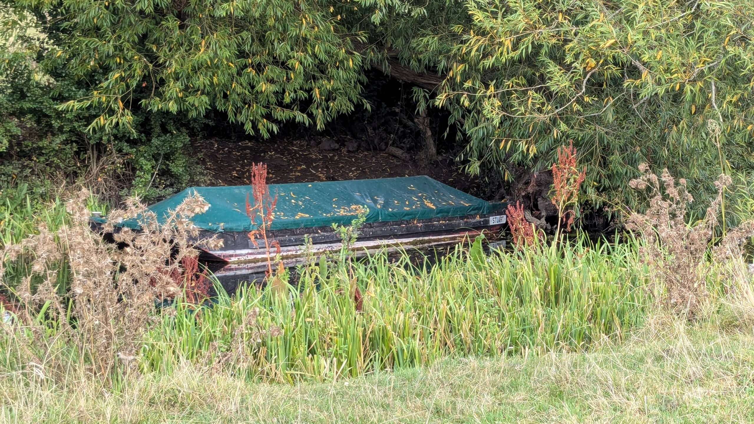
"Stuart" At Rest On The Stroudwater
Many of the original bridges and other structures are still there or have been restored and the towpath itself is steadily being repaired and resurfaced by volunteers from the Cotswold Canals Trust, who are managing the restoration.
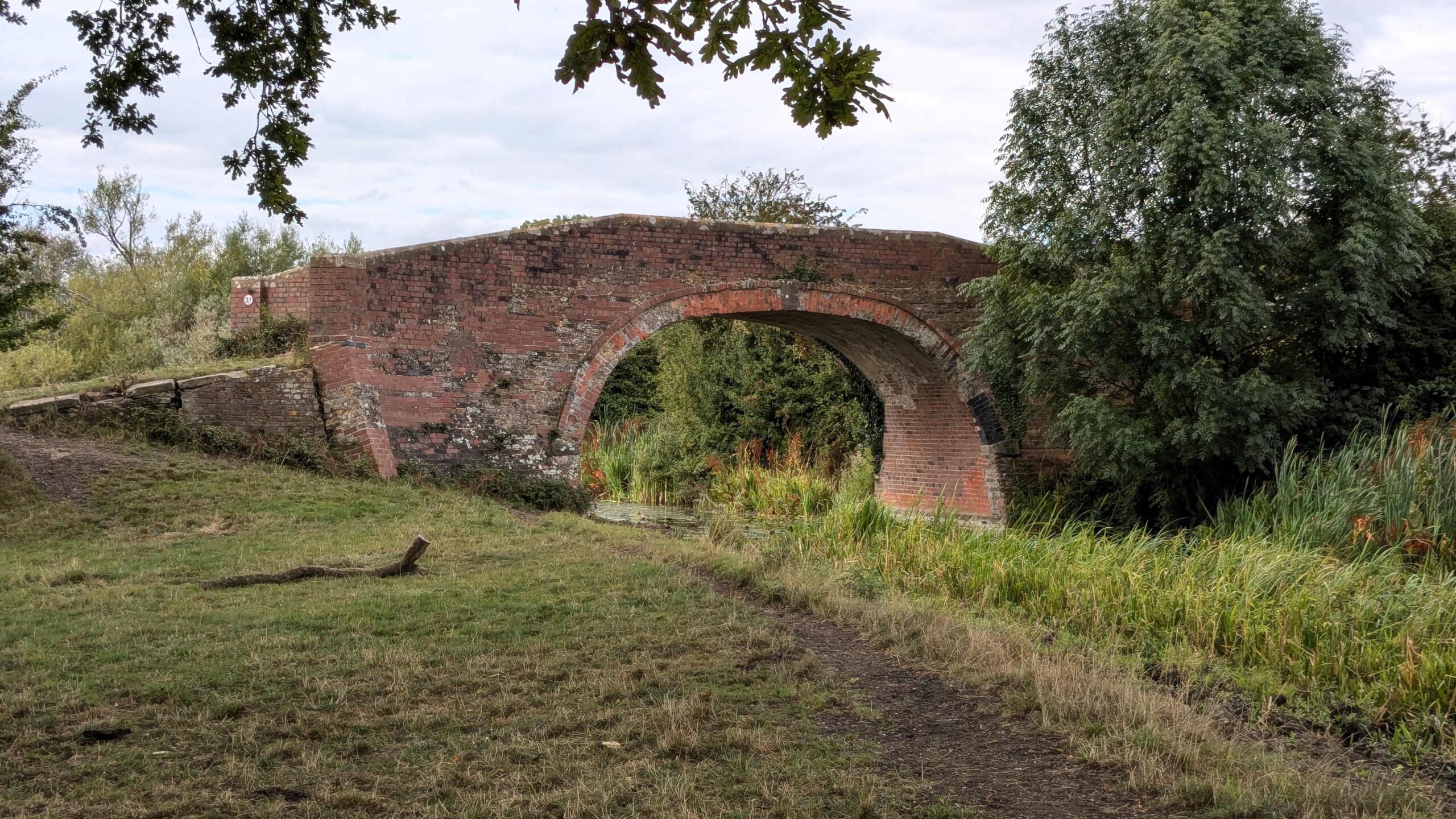
Occupation Bridge
There is no land access to the marina beside the canal so we had to follow the road round to the gate inland. Back on the boat we arranged for a taxi to collect us the next day and prepared the boat to be left for a few days.
The City Of Gloucester
We were back on board at lunchtime on Tuesday tenth September. We had had quite a bit of rain while we had been away and it was a wet afternoon, although the Sainsbury's delivery managed to find a break in the rain. One of the main tasks as soon as we arrived was to reset the heating system to run a bit longer in the morning and turn the rads up from their summer setting.
We got the boat ready, filling and emptying tanks as appropriate, settled up with the marina office and were on our way by ten-thirty on Wednesday, heading to Gloucester. While we were away we had checked with the lock keeper and there were no Spring tides, which we would want to avoid, until the sixteenth September, so we had a few days in hand. However, we had also received the news that the Elsan disposal in Gloucester was out of order, which would have some influence on how long we could stay in Gloucester.
The first obstacle was the junction. The Stroudwater emerges so close to the bridge that it is not permitted to try and turn right. Instead you have to turn left towards Sharpness and wind on the Gloucester & Sharpness, by the Visitor Centre, to then head up to Gloucester. That manoeuvre went quite well, despite a blustery wind and a short wait, treading water, for the traffic lights.
It took just over two hours to cover the last eight miles or so to Gloucester and we chose to use a forty-eight hour mooring on our right, just before the Llanthony Lift Bridge that lets you into the docks beyond, as we planned to get water just across the canal before we set off later in the week. The mooring pontoon turned out to be right under a busy gym and a row of bars and cafés, all with tables outside. Just as we arrived the wind, that had been moderate, suddenly picked up in strength and seemed to be deflected straight off the high buildings here. It was a real struggle to hold the boat, never mind pull it in and once moored, caused the boat to keep trying to swing out until we managed to add additional lines as a 'spring'.
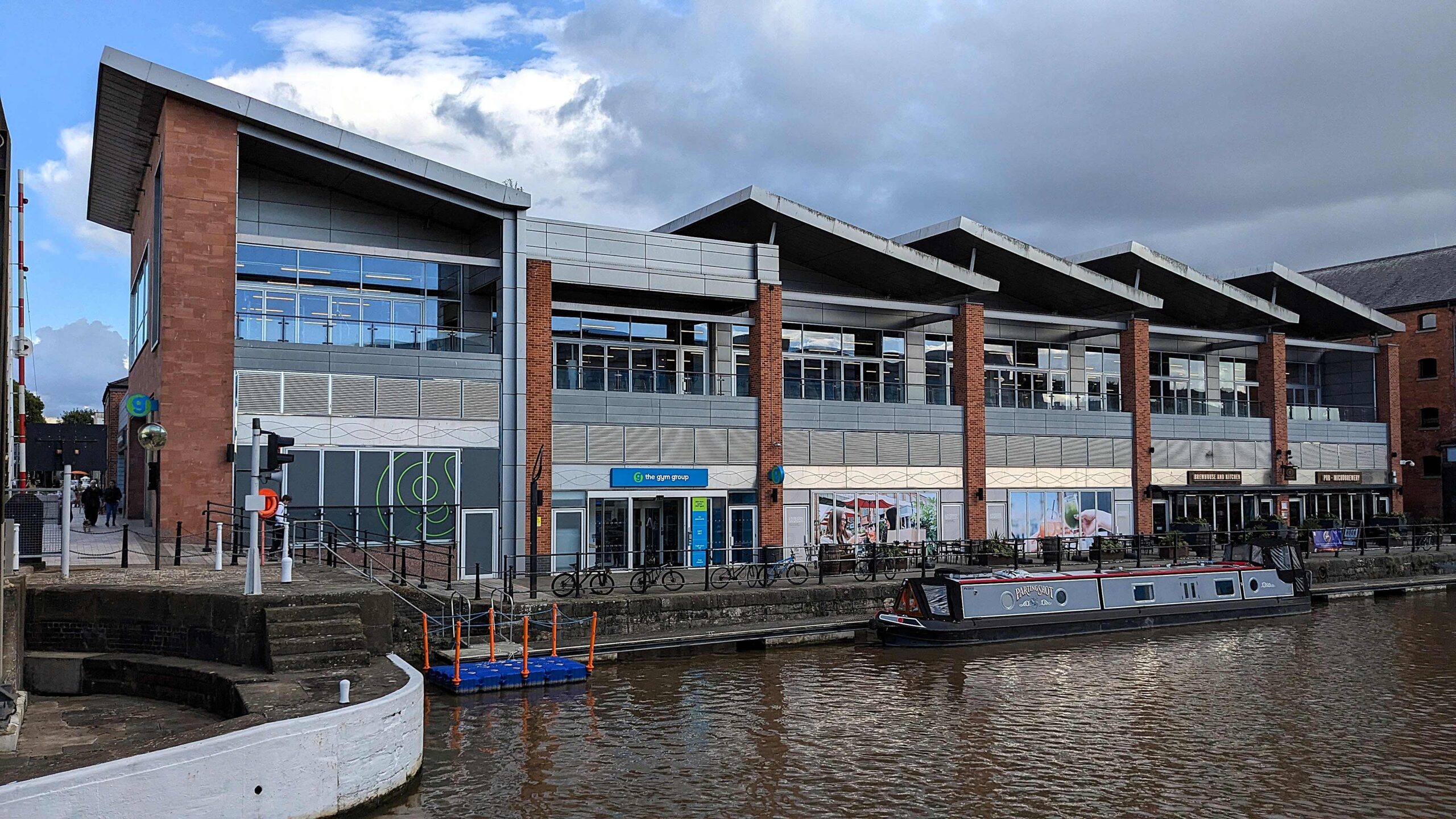
Mooring At Gloucester Quays
A quick look around showed that these premises were just the immediate waterfront part of the 'dining quarter' of the Gloucester Quays shopping centre, which describes itself as "the South West’s premium designer outlet and lifestyle destination" and takes up much of the redeveloped dock area. At this end several blocks of modern buildings house, at ground level, every food and drink chain you can think of, from the Anatolian Palace through Nando's to Zizzi's.
As an antidote to Gloucester Quays we walked across Llanthony Bridge to Aldney Island and followed the river from the lock down to Lower Parting and up the Severn round Port Ham before following the Eastern Channel back to Castle Meads. With the railway, roads and electricity sub-station it isn't entirely peaceful but it is a great open space so close to the city.
We also walked around the main dock area, which has a lot of interesting features. There is a boatyard on the west side where large vessels can be seen in dry dock being refitted and repaired. On the East side is CRT's National Waterways Museum incorporated into the overall Gloucester Quays development. We saw the pontoons by the lock, where we could have moored. There was plenty of space but it, too, was right by a range of pubs and the public walkways so there was no real advantage to moving down here.
Across the canal from our mooring was a large complex of industrial offices, sports and school buildings. The path that runs along the canal in front of these buildings then opens out into the grounds of Llanthony Secunda a twelfth century Augustine priory. After four centuries it ran into the dissolution and the priory buildings were taken down or used as farms and the grounds turned into orchards. On the site here there are remnants of mediaeval ruins and brickwork set among the wide lawns but two buildings from the fifteenth century have been restored and now provide an information centre but also an events venue for weddings or corporate functions.
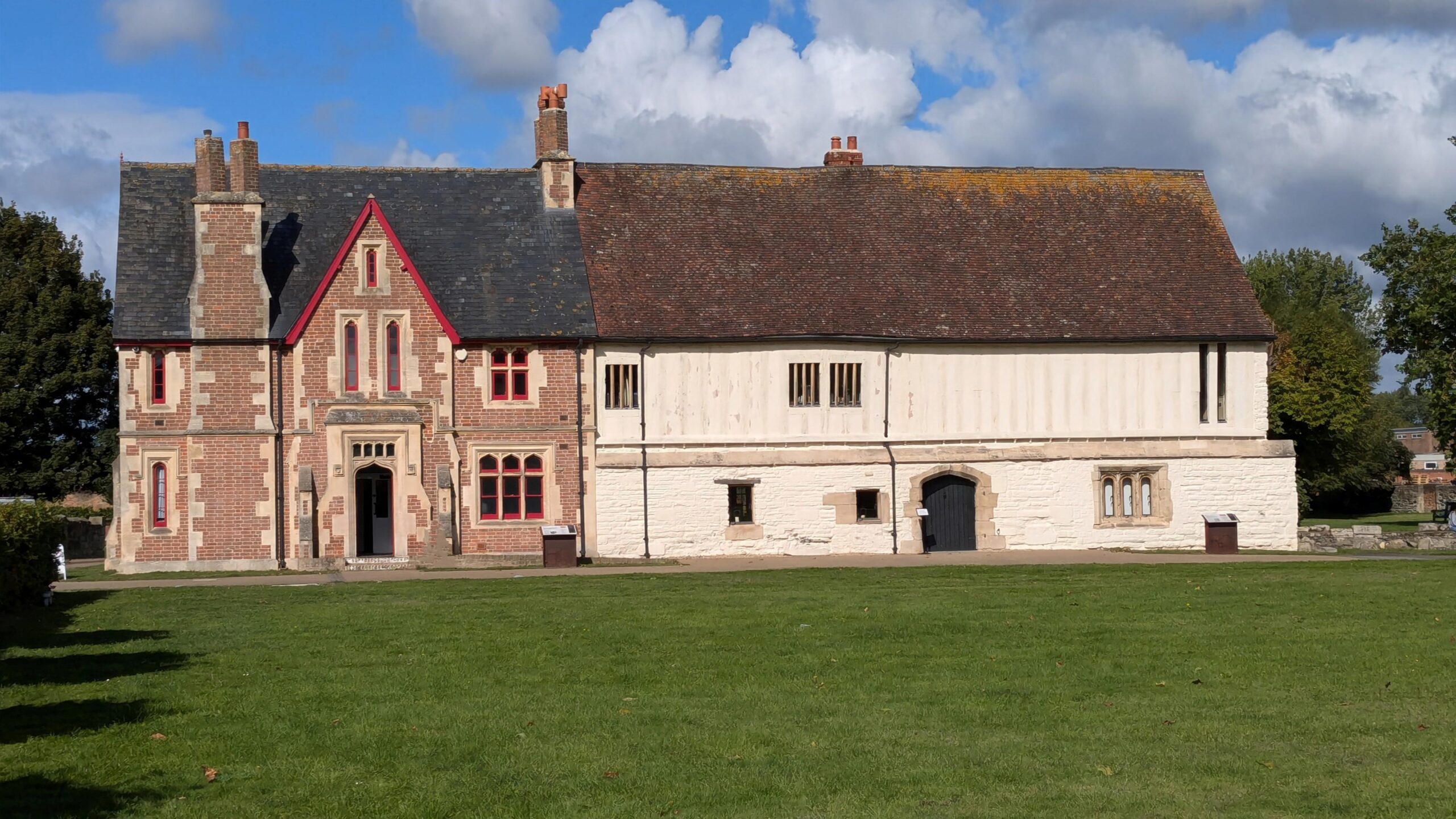
Llanthony Secunda Priory
The attractive setting is only slightly spoilt, on a weekday, by having the main entrance to Gloucestershire College open out onto it. Naturally, at any opportunity, the students spill out onto the grounds to play football or find a quiet vaping spot.
Moored beside the priory is Light Vessel 14 "SULA". Commissioned in nineteen fifty-eight she was stationed at Spurn Sandbank five miles offshore from the mouth of the Humber for a quarter of a century before being put up for sale to be scrapped. She was rescued then and over the next thirty-five years has been through several name changes and periods of restoration and service as a tourist attraction, an historic museum and a therapy centre. She has been moored in Guernsey, Conwy, Milford Haven and Castletown in Ireland before again being rescued from the scrapyard and towed from Waterford to Sharpness in two thousand and seven. After three years restoration she was moored in Gloucester Docks and in two thousand and twenty she was purchased again. As the restoration continues she now offers luxurious holiday accommodation, while the Old Engine Room has been converted into an event and function space for hire. The accommodation here does look stunning! .
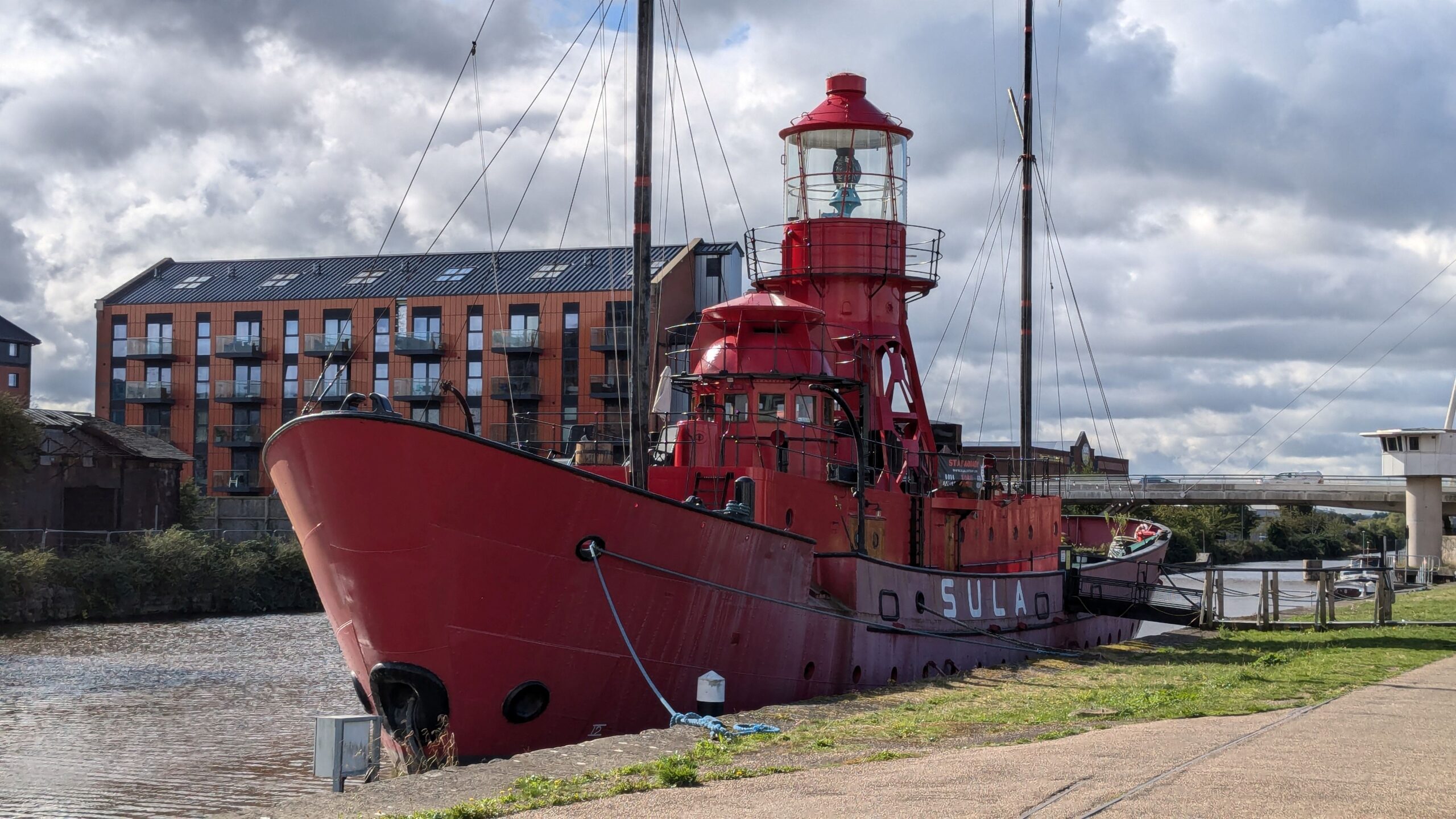
Light Vessel 14 SULA
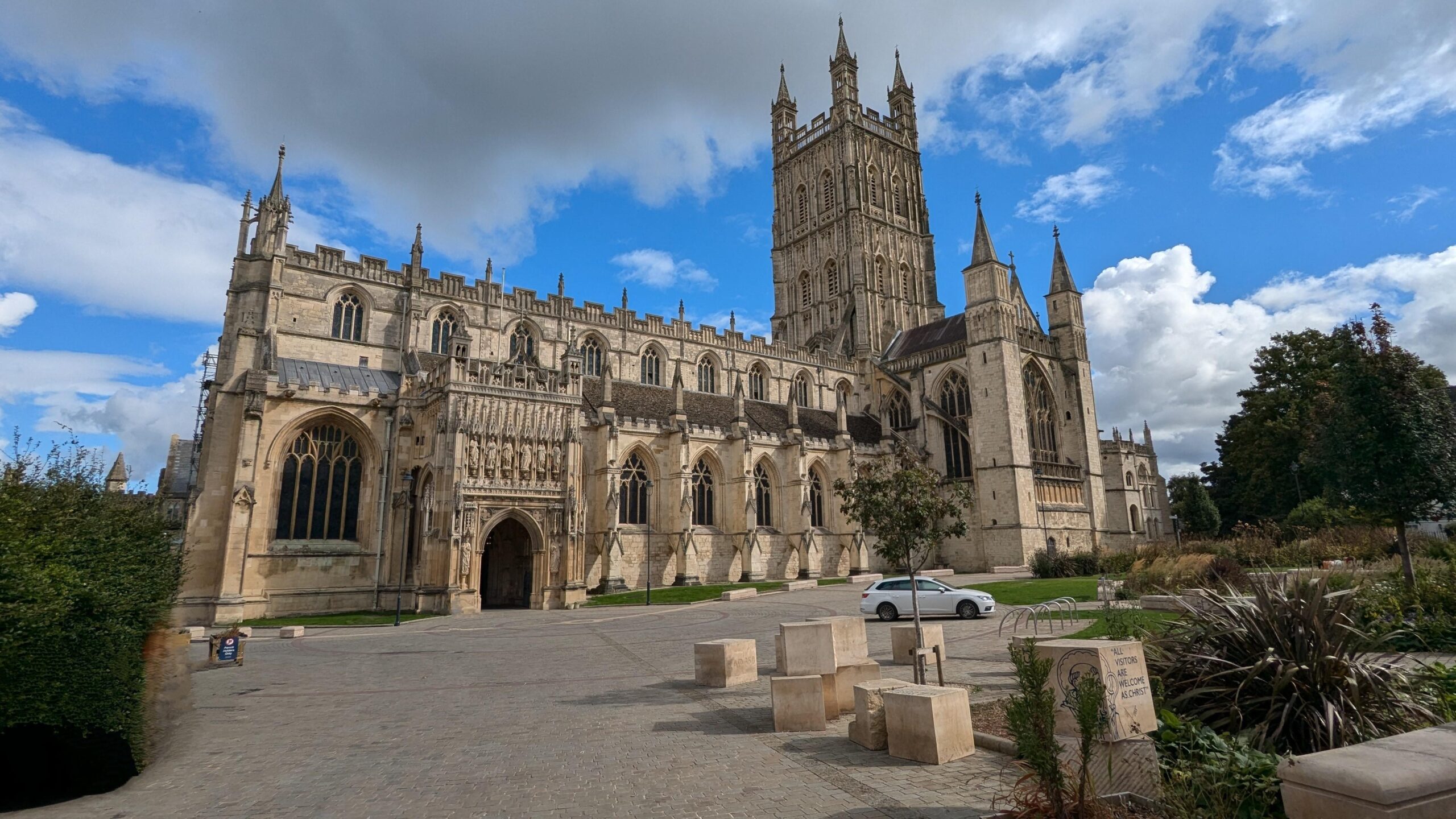
On Thursday, having explored the priory and the light ship, we set out to follow a couple of self-guided tours for the city beyond Gloucester Quays, that we had found online. The city centre tour started from Gloucester Cathedral, which is magnificent.
Gloucester Cathedral
We paused for coffee at the Comfy Pew, nearby, then continued the tour. There was an awful lot to see on the city tour and I don't think we ever fully got to grips with the geography. We found the House of the Tailor of Gloucester in College Court
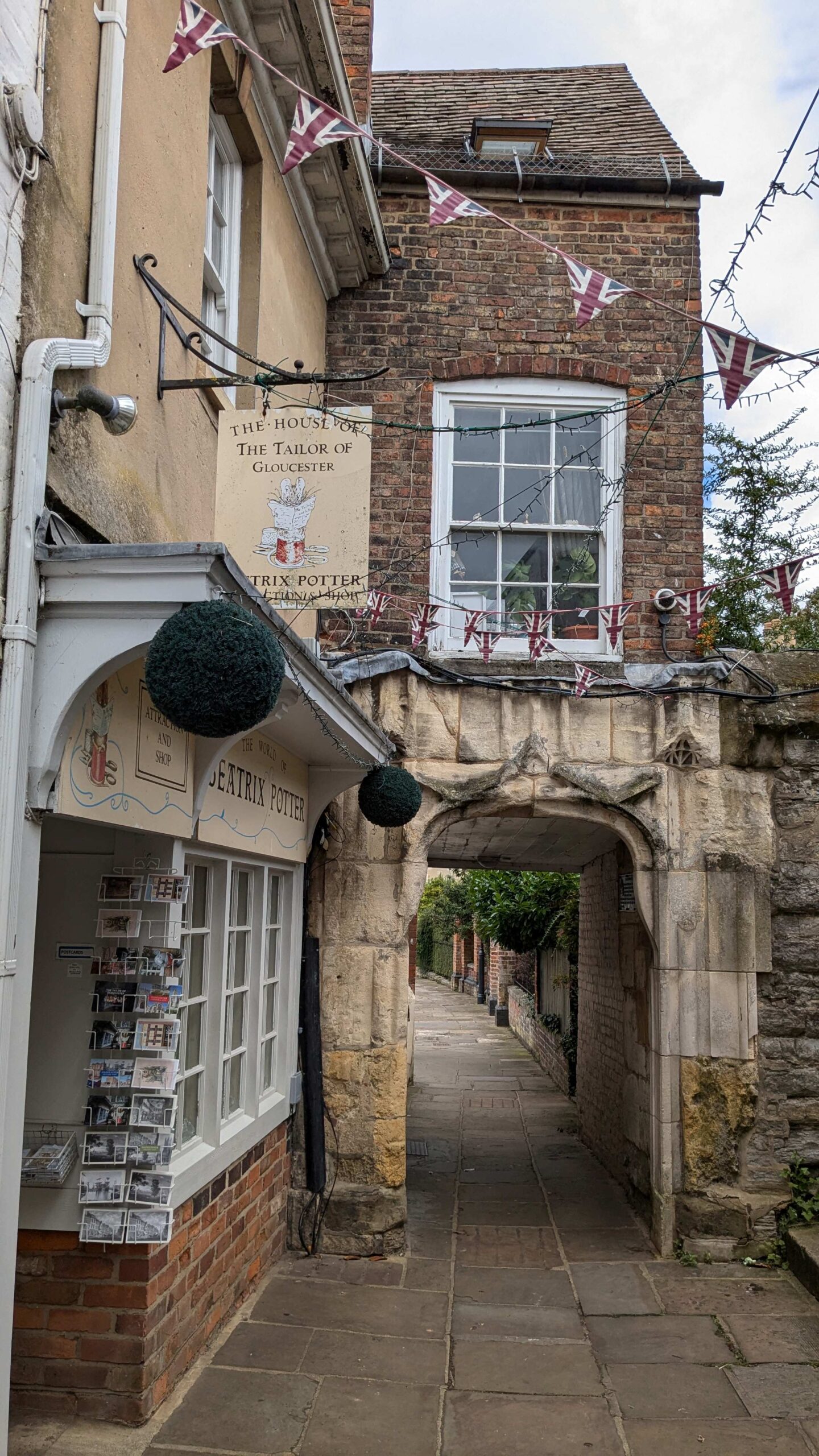
College Court & St. Michael's Gate
and the beautifully preserved Edwardian shop front of Baker’s Jewellers. With the chiming clock above, whose bells are struck every quarter hour by the colourful figures depicting Father Time and national dress of the British Isles, it completely outclasses its modern neighbours.
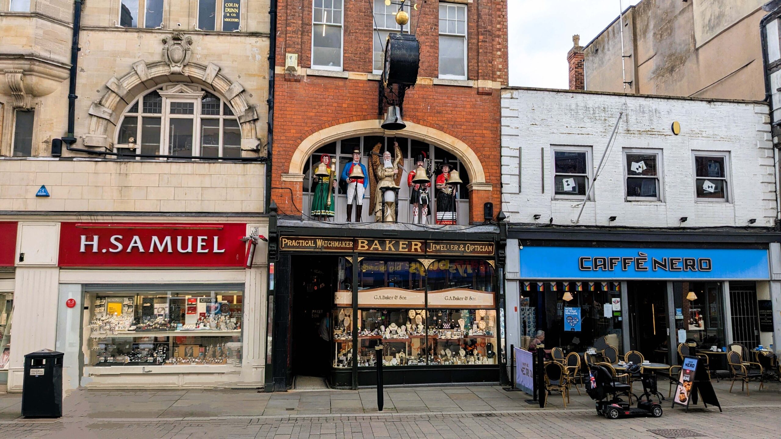
Baker's Attractive Shopfront Between The Best We Can Do In Modern Times
Similarly, the imposing Eastgate Portico, embarrasses the ugly modern shopping centre to either side.
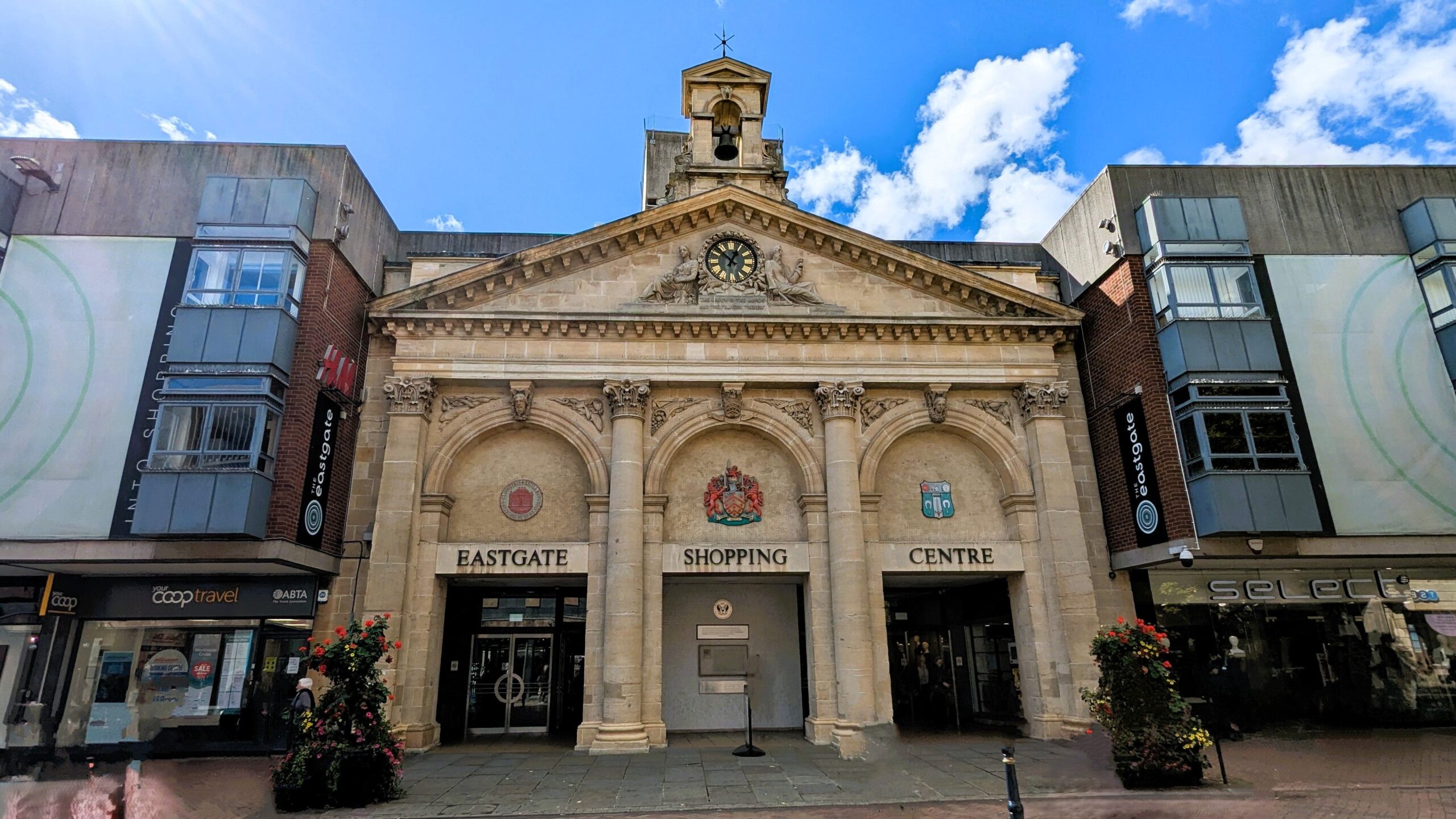
Eastgate Portico
Originally built in eighteen fifty-six for the newly built market, which housed traders in off-street pitches away from the congestion of Eastgate Street, the portico was moved here in nineteen seventy-three. At least it wasn't demolished.
In the afternoon we moved on to the Docks tour and then visited the National Waterways Museum run by CRT. Among many interesting exhibits were a number of short video displays dotted around the halls. These showed fascinating reminiscences from people who had worked on the Severn and the Gloucester & Sharpness in the fifties and sixties. There was one, in particular, from a man who had gone back to work there in the nineties that described how different he had found everything, from the sense of total entitlement to appropriate anything that was passing through the docks that he remembered from the past, to the crippling obsession with health and safety that he encountered in the later era.
Severn Up To Worcester
Friday was the thirteenth of September but we decided to risk it. You are not allowed to pass through Llanthony Lift Bridge between eight-twenty and nine o'clock on weekdays. The Gloucester Lock Swing Bridge is similarly restricted and is also prohibited from four-thirty until five-thirty in the evening. We started with a trip across the canal to the water point before we left. All the time we had been moored here a bridge keeper had been in the control room for the Llanthony Lift Bridge all day but today it was empty. While we were filling up with water I tried ringing the bridge but got no answer, so we tried the Lockkeeper. It turned out that, for today, one man was fulfilling both functions and he was currently working the lock.
By the time he returned we were ready to leave but once through the bridge, we had to mark time in the dock basin while we watched him make his way along the dockside towards the lock. It wasn't a very long walk but by the time he had stopped to take a couple of phone calls and had a chat with some acquaintances on the way, we seemed to have been hovering for quite a while. Once he arrived at the lock he got us moving fairly quickly. We did ask him about any issues we should be aware of and he mentioned reports of some trees in the water near the next junction. Very soon, we were heading out on to the River Severn once again.
The River Severn splits into two channels round Alney Island. Turning left out of Gloucester Lock would take you towards the junction with the Western Channel, known as Lower Parting. However the Llanthony Weir prevents navigation in that direction and the lock that once allowed passage past it is long since disused. From the lock you must head along the Eastern Channel to the northern junction with the Western Channel at Maisiemore, known as Upper Parting. Another weir, with accompanying disused lock, prevents any navigation into the Western Channel here and the route continues north up the main river. The construction of the weirs at Llanthony and Maisiemore was intended to control the effect of the tide and render the river above these points non-tidal. In practice, the highest tides can still overtop the weirs and the river can then become tidal all the way to Upper Lode Lock. The Severn Bore can also be observed from Maisiemore.
Today started cold but fine and sunny and quite calm. The tides were not exceptional and so we could cruise up to Upper Parting quite safely. The evidence of the river's power was clear around us, with fallen trees along the banks and all manner of flotsam in the water. As we approached the Upper Parting a large tree was down across the water from the east side, presumably what the lockkeeper had told us to watch out for. We had to manoeuvre around it, moving way out towards the west bank. This was the moment that the "Edward Elgar", the largest capacity inland hotel boat in the UK, eighty-eight feet long and three decks high, came around the bend, on the way down from Worcester, looking to occupy the same stretch of water.
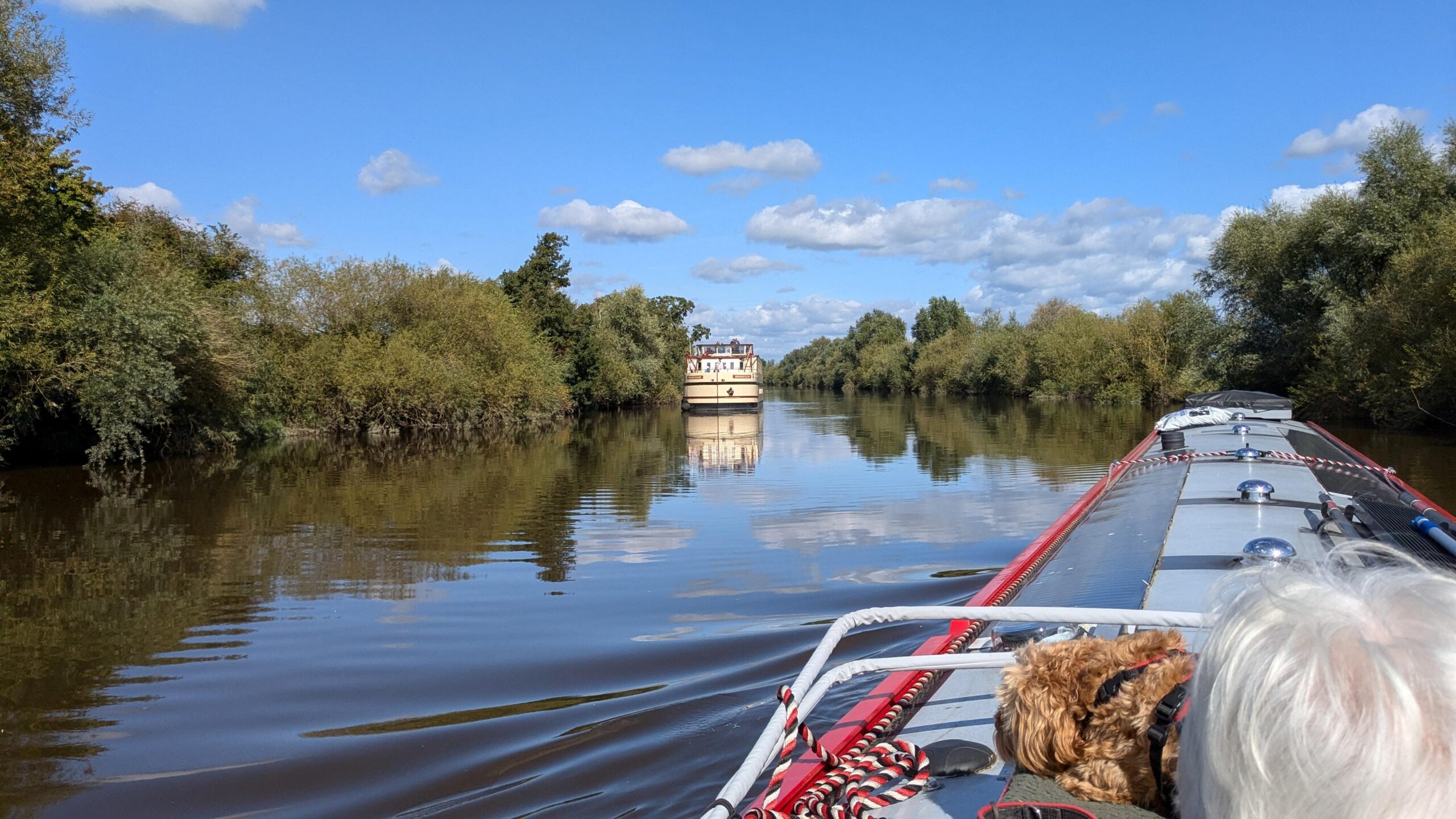
"Edward Elgar" Approaching
We saw them far enough ahead that I'm sure we were in no real danger of collision but it did come as a bit of a surprise, with our attention on the obstacle we were avoiding. We steered hard to starboard and got out of the way as quickly as we could and they gave us a wave as they steamed past.
Being out on a big river meant we could push the engine to a dizzying seventeen hundred revs, although we were moving against the current and it still took three and a half hours to cover the twelve and a half miles to Upper Lode Lock, just short of Tewkesbury. It was still a lovely sunny day and very hot in the sun. The scenery was great but steering from the stern deck, along a wide river, with virtually no traffic gets a bit tiring. We asked the lockkeeper at Upper Lode if we could moor there overnight, which he agreed to if we could fit on to the pontoon. We could, so we called it a day there. Shortly after, another boat arrived from the north. They had apparently phoned the lockkeeper from Diglis Lock, on the way down, to ask the same question and had received the same answer. There wasn't quite room for both of us but they managed to secure their stern and ended up with their starboard bow resting against ours, which seemed to work.
I took Archie for a walk over a place called Cork's Hill and down to the Lower Lode Inn. There is mooring there for patrons only and we had considered stopping there before we reached the lock and perhaps it was just as well that we hadn't. When we got there on foot, we saw that a motor cycle club was arriving for a weekend outing. The whole place was swamped with old men on two wheels trying to find space in the grounds to scratch their heads over how their festival tents were supposed to fit together. We picked our way through the scattered luggage and headed back up a path along the river to the boat.
Saturday morning was fine and sunny again, good weather for another longish cruise up to Worcester. We were ready to leave at ten o'clock and sure enough, having seen no boats all morning, "Freestyle" emerged from the lock behind us with another boat following behind. They seemed to be travelling together and were certainly in no hurry so once we started moving we were soon coming up behind them. While we were maintaining a steady sixteen hundred and fifty revs we were not moving that fast against the current. However, we were still steadily overhauling them and eventually overtook them, in agonising slow motion, shortly after Tewkesbury.
It was a pleasant enough, slightly dull cruise to cover the sixteen and a half miles to Worcester and the junction with the Worcester & Birmingham Canal in about five hours. Having phoned ahead we found the Diglis Locks on the Severn ready to receive us. At that point we needed to manage the two locks into the canal, also rather confusingly called Diglis Locks, for ourselves. Sue dropped me at the lock landing pontoon on the river while I went up to work the lock in the middle of a really busy Saturday afternoon.
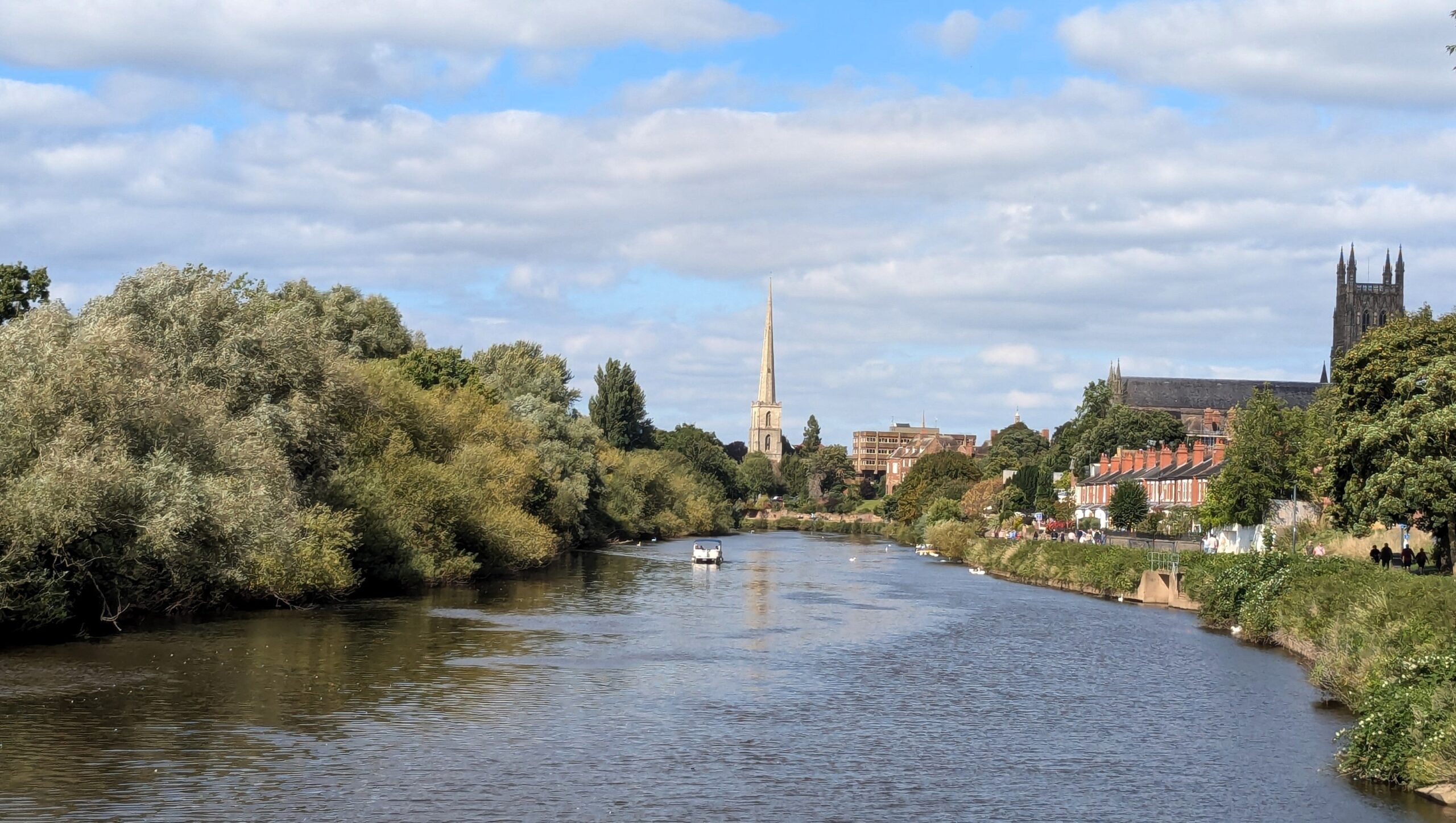
Approaching Worcester
It was a really nice day for stroll along the river bank and the gongoozlers were out in force, a recipe for embarrassment. For once, it was not a problem. Sue handled the turn into the bottom lock with aplomb, the locks actually worked reasonably smoothly and we didn't drop anything in the water. After a short stop at the services we moved up to the visitor mooring, which was pretty full. It is a stone wharf with mooring rings here and while we could get a line on for the bow there were no rings left at the back for our stern line. An Anglo Welsh boat, "Pembroke Castle", was moored near the end with a lone passenger left on board to mind the boat. After a little persuasion, he agreed to let me move their lines up one ring's length to allow us just enough space to get the stern tied up. We were grateful for that as we really didn't want to have to move on further through more locks to find a mooring.
After a period of recuperation I went up into town to treat ourselves to a pizza. It soon became clear that we had arrived on the weekend of the Worcester City Runs and event attended by thousands. The contestants and their supporters, having enjoyed their day, were spilling out onto the streets outside every pub, so I walked a little outside the main centre to find an Italian restaurant that still had capacity to supply a takeaway pizza.
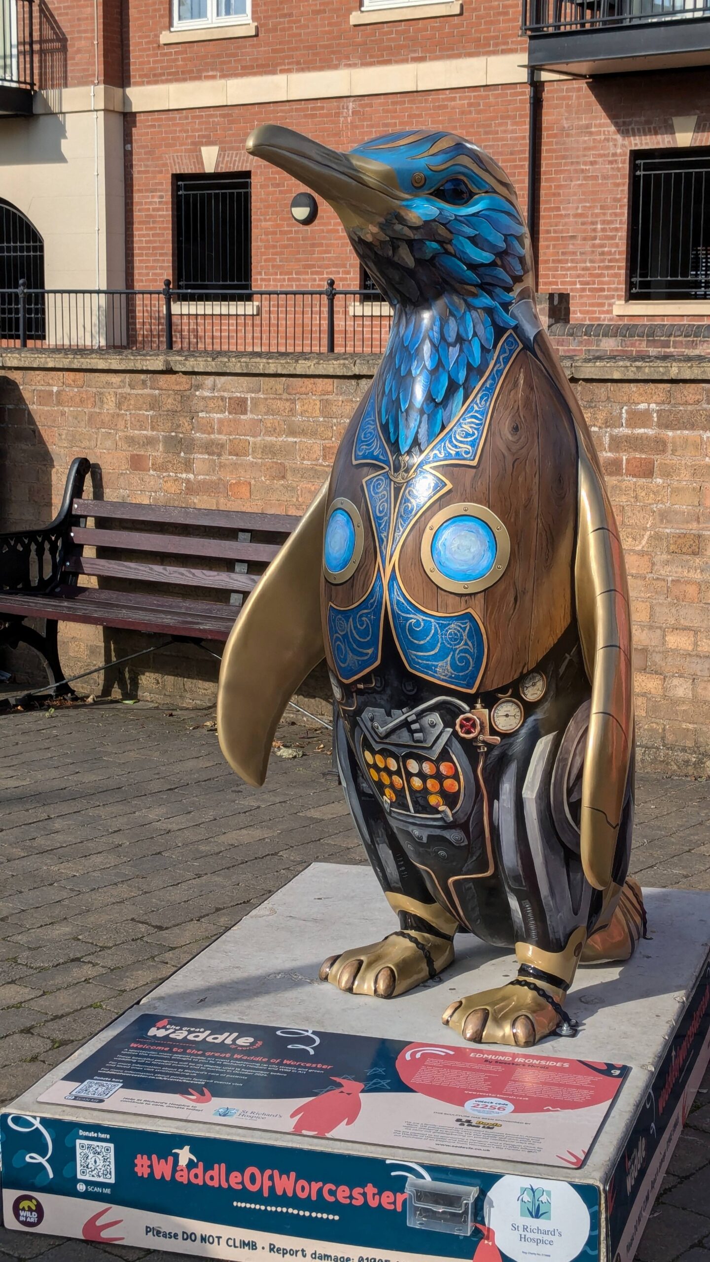
On the way, I passed a number of odd statues. Sunday was also the end of the Great Waddle Of Worcester 2024. Some forty of these models had been set up as a city-wide art exhibition and the focus of a walking trail around the city. The trail had been running since late July and was also in support of St. Richard's Hospice.
-
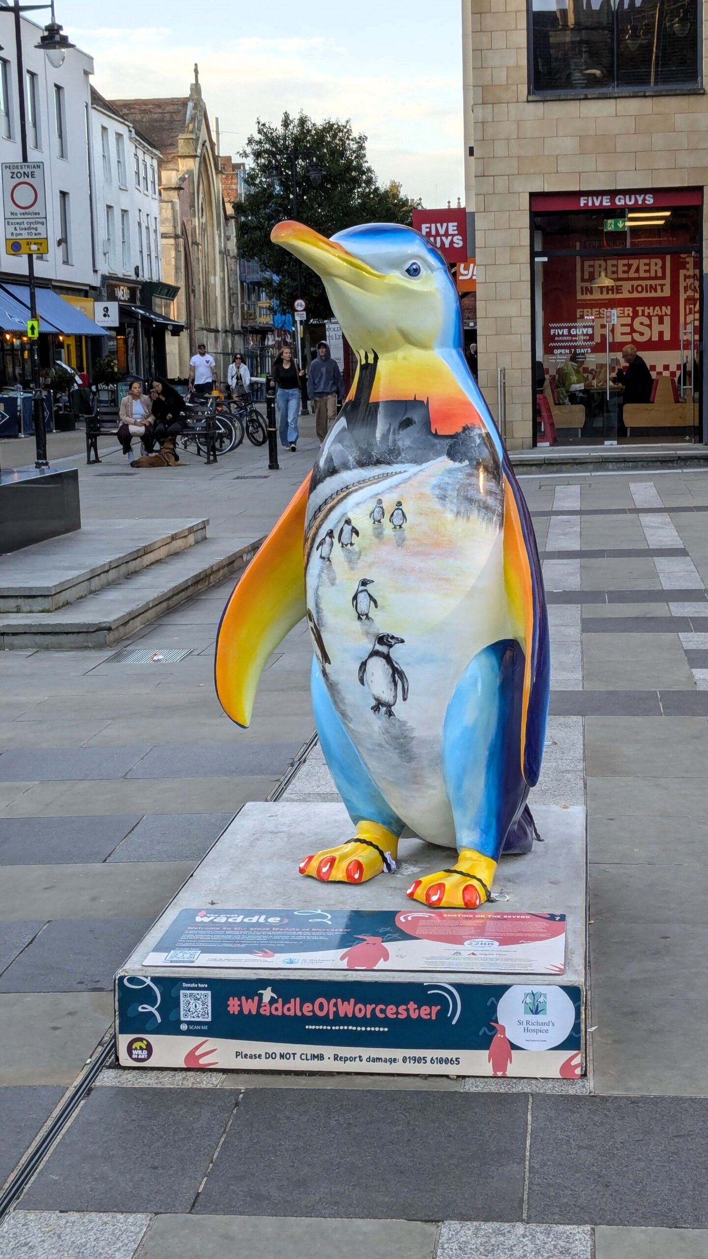
- Great Worcester Waddle
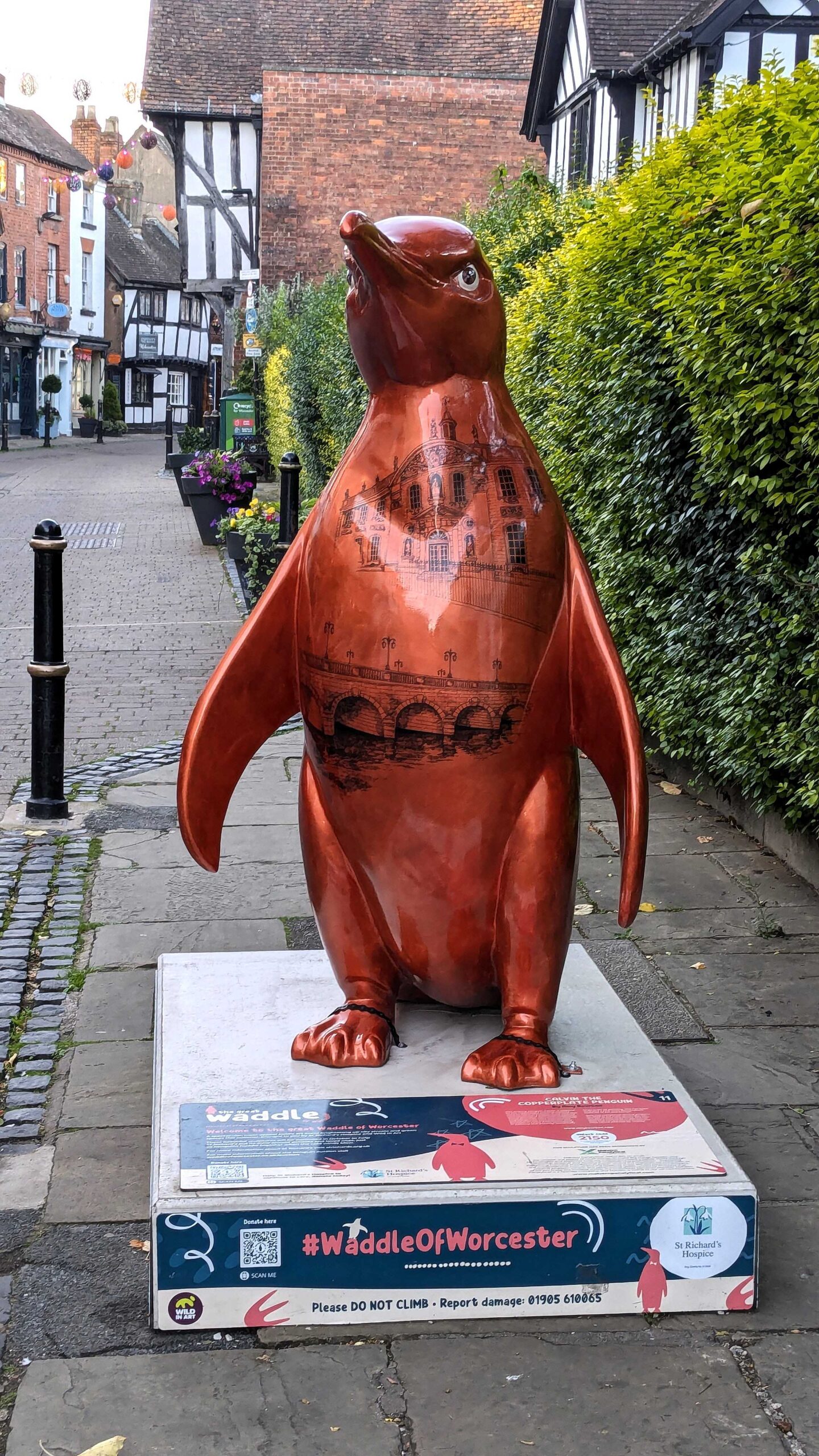
These that I passed certainly made an impressive and colourful punctuation in our trip.